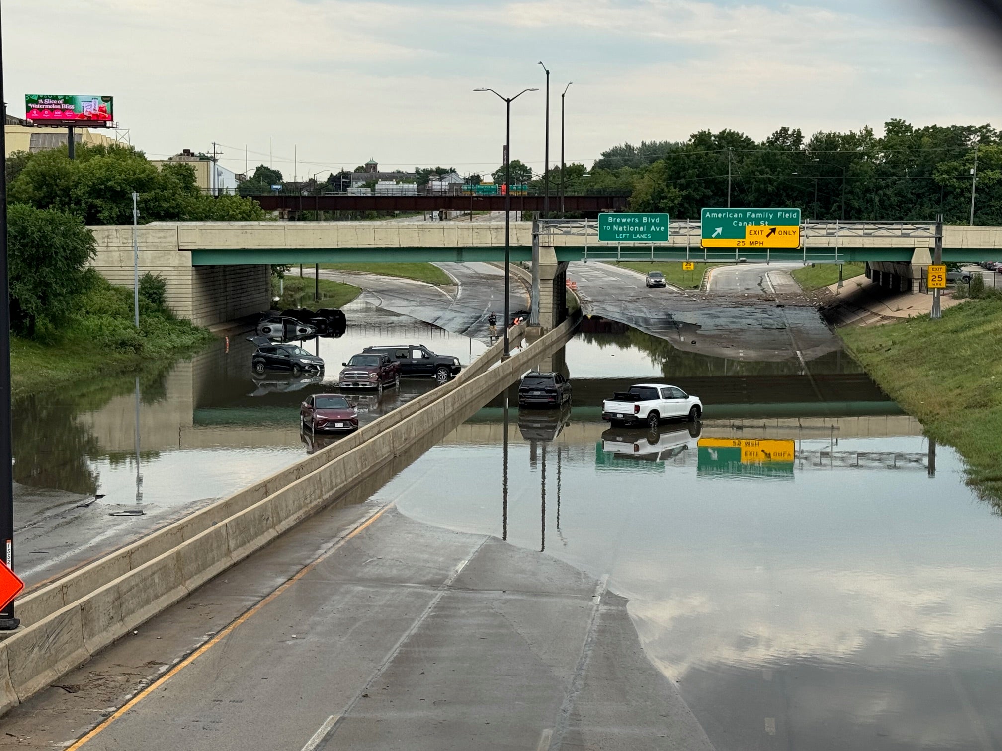
Heavy thunderstorms and rains over the past several days have caused flooding in northern Wisconsin, killing two people and resulted in a number of closures and washouts to roads including U.S. highways 53, 63 and 2. The rainfall is expected to cause high waters in some areas similar to flooding that occurred in June 2012, according to the National Weather Service.
Law enforcement officials in Ashland County issued a press release Monday confirming the body of a man was found near his truck in a flooded roadway Sunday in the Township of White River. Officials in Sawyer county also confirmed a storm-related death Monday, saying a man was killed early Sunday morning when a tree fell on a camper in the Town of Edgewater.
The flooding comes just days before the six-year anniversary of the flood that caused tens of millions of dollars in damage to northern Wisconsin and Minnesota when 10 inches of rain doused the Twin Ports region on June 19-20.
News with a little more humanity
WPR’s “Wisconsin Today” newsletter keeps you connected to the state you love without feeling overwhelmed. No paywall. No agenda. No corporate filter.
Flash flooding has impacted roads in at least four northern Wisconsin counties, including Douglas, Ashland, Bayfield and Iron counties.
Douglas County officials have issued an emergency travel alert and declared a state of emergency, according to Douglas County Emergency Management director Keith Kesler.
“It’s a situation where some of the roads are getting undermined and will just suddenly collapse,” said Kesler. “When you’re driving along, it may look like everything’s fine, but there may not be anything underneath you. We’ve had several instances both in Douglas and Bayfield County where people have driven through deep water and floated off the road and had to be rescued.”
At least half a dozen people needed to be rescued on Sunday due to flooding, according to Bayfield County Sheriff Paul Susienka.
“It’s been really difficult. Often times it takes so much longer than normal because we have to take alternate routes to get around,” he said. “We’re finding washed out roads as we try to respond to calls because we haven’t gotten reports on obviously every road yet.”
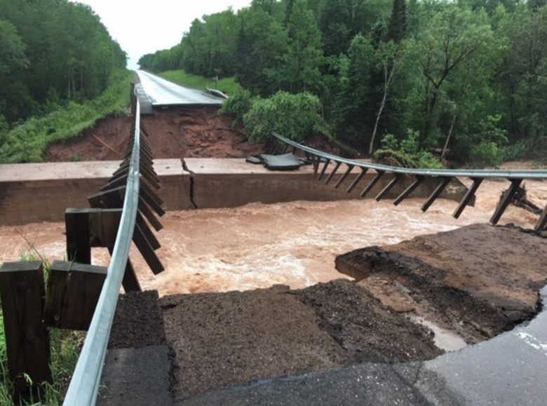
Susienka said the flooding in Bayfield County seems worse than the deluge that occurred two years ago because the damage to roads is more widespread. U.S. Highway 2 near Ino has been washed out between County Highway G and Tomich Road. The Wisconsin Department of Transportation said the damage will mean a long-term closure, according to Jessica Felix, the agency’s northwest region deputy director.
“We’re working to expedite that fix as soon as possible similar to what we did at Grand View back in 2016,” said Felix.
However, Felix said it was unknown at this time how long repairs may take. U.S. 63 was closed in Bayfield County for about a month after flooding in July 2016. Felix added that the department is suspending all oversize/overweight permits in Douglas, Ashland, Bayfield and Iron counties. In addition, southbound traffic on U.S. Highway 53 has been redirected to the northbound lane by Bennett and Solon Springs.
High water levels on the Nemadji River in Douglas County are expected to be near those seen in June 2012, according to Dan Miller, science and operations officer with the National Weather Service in Duluth. As of 4 p.m. on Sunday, the river was recorded to be at 29.08 feet — surpassing the record high of 27.37 feet last seen on June 21, 2012. He said northern Wisconsin might also witness similar flooding to July 11, 2016 when 10 inches of rain caused major travel disruptions for days throughout northern Wisconsin.
“We’re probably looking at a crest that’s going to put water over the road with the Bad River on U.S. 2 that’s over near Odanah,” he said. “We’re probably looking at a record crest for the Brule River and records for the Brule River go back to around 1950.”
Miller said they’ve received reports of close to one foot of rain within the span of six hours on Saturday night in portions of Douglas and Bayfield counties. He said the two counties likely saw a total of 12 to 14 inches of rain.
“That’s an incredible amount of rain to fall in less than 24 hours, and that’s why we’ve got this massive water problem with water moving through all the drainage channels and the rivers right now.”
Areas throughout the region have reported 13 inches of rain, according to Bayfield County Emergency Management director Jan Victorson. People are reporting flood damage to basements, driveways, and homes in addition to public infrastructure. People are urged to report damage by calling 2-1-1.
Officials advised people not to travel across northern Wisconsin and stay away from moving water and flooding on roadways. They urged people to heed road barricades and refrain from going around them.
“I’ve seen pictures of road that’s wrinkled up like a piece of bacon for many, many feet,” said Kesler.
Kesler said they’ve also received reports of roads washing out that were rebuilt after flooding in the last several years. The county has listed a number of roads that are closed on its website. Bayfield County and Ashland County have listed road closures on their websites.
A tornado watch was suspended on Sunday evening for northern Wisconsin. Rain and storms were expected to diminish by midnight or 3 a.m. early Monday. The rest of the week is expected to be fairly dry through Thursday, according to Miller with the National Weather Service.
The following is a list of road conditions from the Wisconsin Department of Transportation that was last updated at 6 p.m..:
Bayfield County
- Highway: US 2
- Location: At North Fish Creek (east of Ino), approximately 1 mile east of the intersection with County G.
- Condition: Road completely washed out.
- Detour: Traffic detoured via WIS 13.
- Highway: US 63
- Location: Between US 2 and Drummond
- Condition: Water over the road in multiple locations and at the structure over Fish Creek.
- Detour: Currently no posted detour.
Douglas County
- Highway: US 53 southbound (*updated*)
- Location: Between Huron Road and County A (near Solon Springs)
- Condition: Closed due to culvert washouts.
- Detour: Southbound traffic moved to the northbound lanes; reducing northbound US 53 to one lane in each direction between Bennett and Business 53 (Solon Springs)
- Highway: WIS 35
- Location: County B to County T (Pattison State Park area)
- Condition: Water over the roadway and impassable.
- Detour: No posted detour.
Iron County
- Highway: WIS 77
- Location: Between Casey Sag Road and WIS 122, west of Upson. Highway closed at WIS 13 and US 51 (Hurley).
- Condition: Repairs made to allow emergency access. Waiting for conditions to improve before opening to through traffic.
- Detour: Traffic detoured via WIS 13, US 2, and US 51.
Editor’s note: This story was updated at 2:3 p.m., Monday, June 18, 2018 to include information about storm-related deaths.

Wisconsin Public Radio, © Copyright 2026, Board of Regents of the University of Wisconsin System and Wisconsin Educational Communications Board.