Wisconsin has some of the most beautiful and interesting parks in the country. We take a closer look at their geological and natural history with our guest, the author of a new book on the subject.
Featured in this Show
-
Wisconsin Used To Be Tropical, And 5 Other Facts You Didn't Know About The State
Wisconsin’s not exactly a tropical getaway.
But it has a tropical past: For much of its history, the state used to be south of the equator.
Science writer Scott Spoolman explains this through a theory called plate tectonics, which says the earth’s outer shell is fractured into a bunch of pieces called plates, which move around.
“The plate that Wisconsin was on was south of equator, and over time it just was jostled and bumped around kind of like bumper cars at an amusement park,” he said. “It crossed the equator about 350 million years ago, and then landed where it is now at 70 million years ago.”
That original geographic placement made a huge difference for the region, Spoolman said, because it made Wisconsin tropical. That meant there was more life in the area than there otherwise would’ve been, had it always been north.
Some scientists believe Wisconsin was home to some of the world’s first coral reefs, Spoolman said.
Because it’s traditionally part of the Midwest, outsiders might think of Wisconsin as a flat, unvaried plain.
In reality, it couldn’t be more opposite, with deep valleys and high ridges to the southwest, hollows and high hills in the north, a glacially carved south and a northeast born of ancient sea floor rocks.
That variety fascinated Spoolman. In a new book, he’s spotlighting the state’s geology and natural history through its state parks.
Spoolman shared a few other facts you might not know about Wisconsin’s geology and natural history:

A view from Blue Mound State Park. Jonathan Bloy (CC BY-NC-SA 2.0)1. The Driftless Area is one of the largest areas of the world that hasn’t been touched by glaciers. Ever.
The region covers 24,000 square miles across Wisconsin, Minnesota, Iowa and Illinois. Characterized by its steep, rugged landscape and cold streams, it looks markedly different from the rest of the upper Midwest because it wasn’t carved up by glaciers 100,000 years ago.
As a result, while much of the rest of the state was flattened by the ice, massive ancient rock mounds like Blue Mound and the Baraboo Range remain in the Driftless Area, like tiny mountains.
“The rock on Blue Mound is actually, it’s called dolomite, and that’s unusual,” Spoolman said. “Dolomite was the top layer that was left all over the whole state after the ancient seas departed. Over those hundreds of millions of years those layers eroded away, for the most part.”

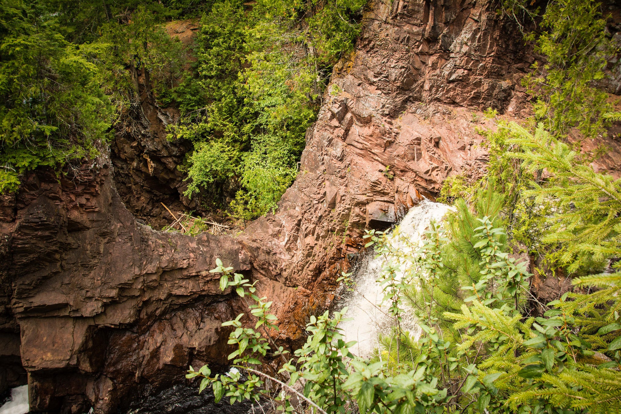
Amnicon Falls katie wheeler (CC BY-NC 2.0)2. Amnicon Falls could have been much, much taller.
The namesake Amnicon Falls of Amnicon Falls State Park, in the northwestern part of the state, flow over a geological formation called the Douglas Fault. As Spoolman explains it, a fault is a crack in the earth’s crust where one block of earth shifted up and created a huge wall.
The Douglas Fault is only about 30 feet tall today, Spoolman said. But if it had risen more quickly over time, it would have towered at 15,000 feet.
“But it rose so slowly that it eroded at the same time,” Spoolman said. “And it was always something like 30 feet like it is now.”

People kayak at Cave Point Park. Richie Diesterheft (CC BY-SA 2.0)3. The ridges in Bailey’s Harbor are old beaches.
In northeastern Wisconsin’s Door County, Bailey’s Harbor is a popular vacation spot, with beautiful beaches on the shores of Lake Michigan. It’s also known for its ridges.
Hundreds of millions of years ago, the lake was much higher than it is today: as much as 30 feet higher, Spoolman said.
“Over time it gradually dropped. Each time it dropped it kind of sat at a new level for a while,” he said. “What happened was, the lake started dropping again, and the area behind the old beach started filling in with plants and life so you ended up with a series of ridges and swales, the areas between the ridges, that are filled with plant life.”

Balanced Rock Trail. Jennifer Tomaloff (CC BY-NC-SA 2.0)4. Wisconsin Dells was formed in a matter of weeks.
Aside from Lake Michigan, Wisconsin also used to be covered by another giant lake: Glacial Lake Wisconsin, which existed some 20,000 years ago.
As the glacier moved southwest from the Green Bay Lobe, it blocked the route of the Wisconsin River and dammed it, creating a giant lake that covered much of the central part of the state, known as the central sand plain.
When the glacier melted, the dam burst.
“All that water just roared out of that lake,” Spoolman said. “The lake had sat there for something like 3,000, maybe even 4,000 years. And geologists think it drained in a matter of weeks.”
That rush of water quickly carved the Wisconsin Dells region, creating landmarks like Balanced Rock and the Devil’s Doorway in a matter of weeks.
If you’re having a hard time imagining it, look at the erosion that happened when Lake Delton emptied in 2008. The Wisconsin Geological and Natural History Survey says the glacial lake was 4,000 times larger than Lake Delton.

Rib Mountain. Justin Belec5. Rib Mountain is so tall because it’s made of one of the hardest rocks on the planet.
Compared to the rest of Wisconsin, Rib Mountain, near Wausau, is a giant. It is the highest mound of bedrock in the state, standing more than 700 feet over the plain below.
The key to its height is in its composition. While old legend says it is the remnant of an old volcano, that’s not true, Spoolman said. Instead, the mountain was likely formed from a chemical reaction between churning rock layers 1.7 billion years ago.
“The pressure and heat and chemical reaction forged new rock called Quartzite,” he said. “It’s very, very hard rock and it’s so hard that it’s stood up to hundreds of millions of years of erosion.”
That means that while the plain underneath the mountain has eroded over time, the rock has not. The plain gets lower, but the mountain continues to tower.
Episode Credits
- Jill Nadeau Host
- Jill Nadeau Producer
- Scott Spoolman Guest
Wisconsin Public Radio, © Copyright 2026, Board of Regents of the University of Wisconsin System and Wisconsin Educational Communications Board.