This story was originally published by Wisconsin Watch.
After a fresh February snow, a satellite about the size of a shoebox, busy snapping photographs as it circuited the planet at 17,000 miles per hour, captured something dark in Wisconsin.
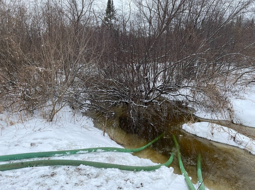
About 56 tons of livestock bedding and manure had been spread atop Mark Zinke’s frozen alfalfa field.
News with a little more humanity
WPR’s “Wisconsin Today” newsletter keeps you connected to the state you love without feeling overwhelmed. No paywall. No agenda. No corporate filter.
The image, beamed down to the surface, eventually appeared on the computers of Stanford University researchers, who relayed it to the offices of the Wisconsin Department of Natural Resources.
A staff member looked it over. He decided it was noteworthy and passed along the information to another employee in a nearby city.
Zinke, a Brownsville dairy farmer who cares for a herd of more than 1,300 cows, had forgotten about the whole thing until he later heard from the agency.
“Oh sh-t,” he recalled thinking at the time. “I mean, it’s just one of those things. I guess we f-cked up. We gotta man up to it, right?”
Zinke wasn’t particularly surprised upon hearing that the witnesses to the manure application were Earth-orbiting satellites.
“This day and age,” he said of the government, “they watch us doing everything.”
The Wisconsin DNR is, in fact, not a spacefaring agency.
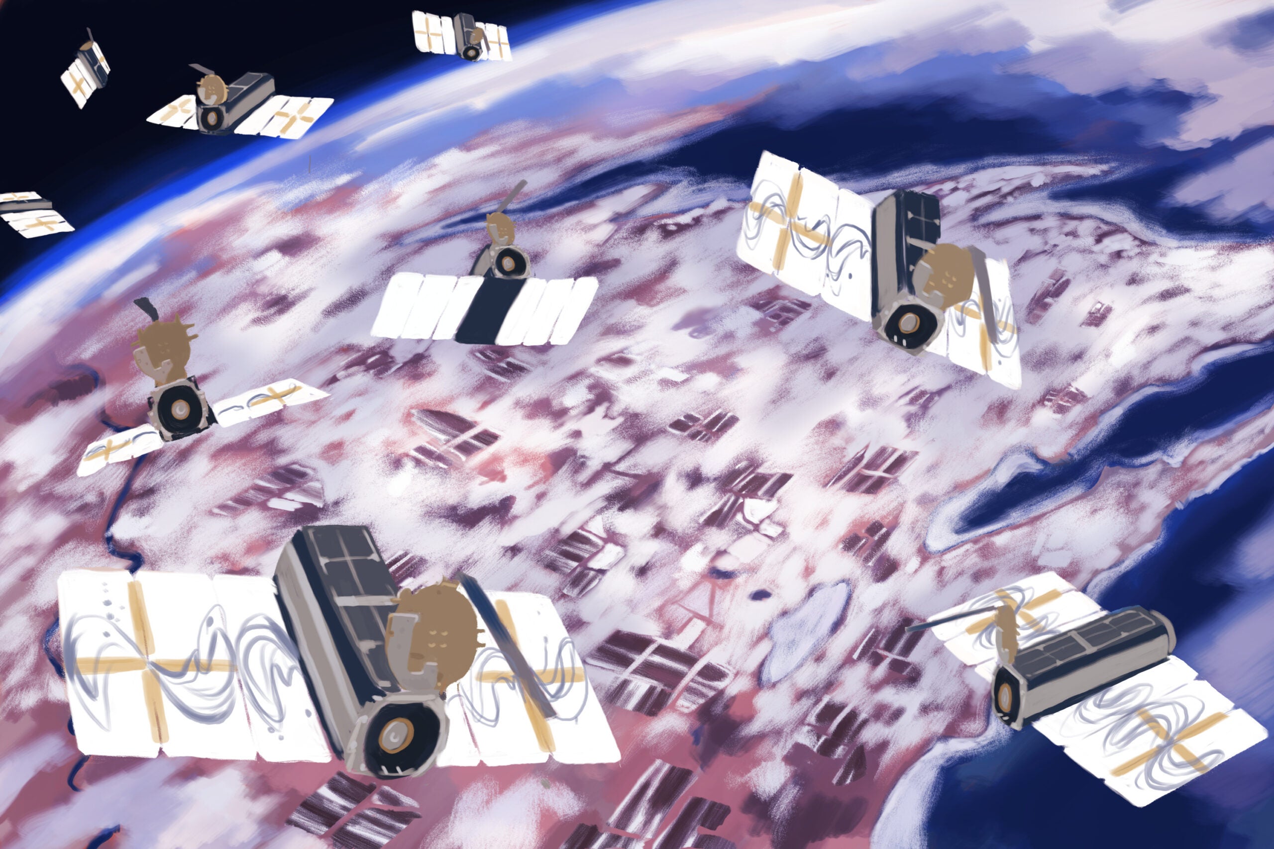
But aerial imagery collected by a new generation of small, inexpensive satellites is ushering in an era of real-time monitoring. Some environmental advocates want the department to look to the heavens as it regulates earthly happenings. Large livestock farms, a potential water contamination source, could become a surveillance target.
With increasingly sophisticated artificial intelligence, such a scenario is hardly a Jetsonian pipe dream.
Scientists from Stanford’s Regulation, Evaluation and Governance Lab are analyzing troves of aerial photographs to teach computers to recognize when farmers butter the land with livestock poop during the winter, a largely restricted but suspectedly pervasive practice in America’s Dairyland.
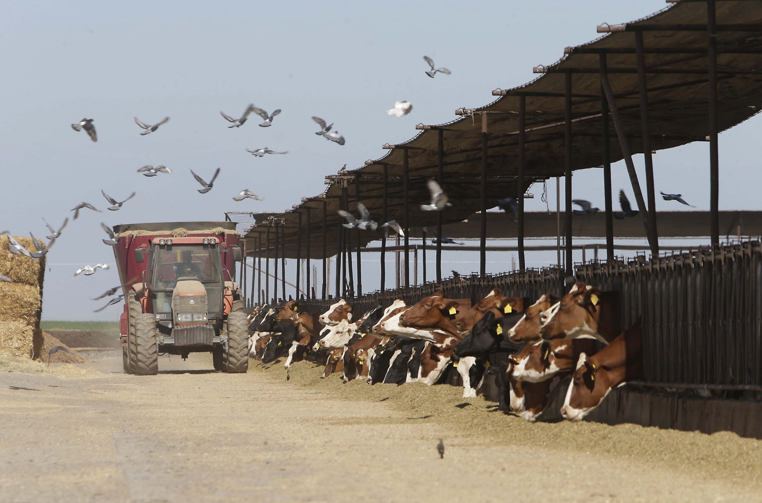
The research relies upon machine learning, a process in which computers identify patterns to make predictions and decisions, and constellations of commercial satellites that scan Earth’s surface daily. The orbiters photographed the large farms — known as concentrated animal feeding operations, or CAFOs — during snowy Wisconsin winters. Policymakers consider a livestock farm a CAFO if it houses at least 1,000 “animal units,” the equivalent of 714 dairy cows or 2,500 pigs.
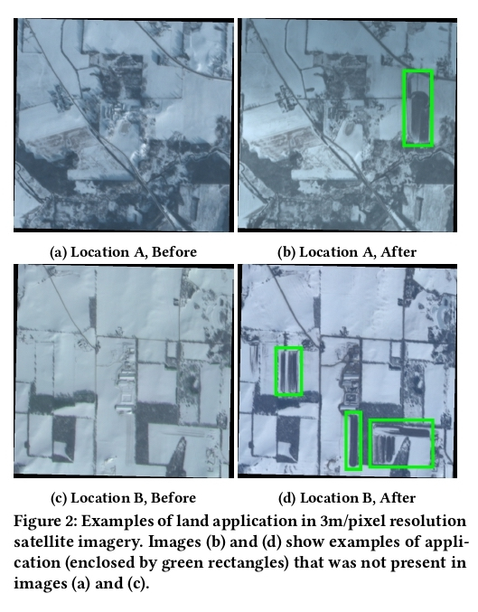
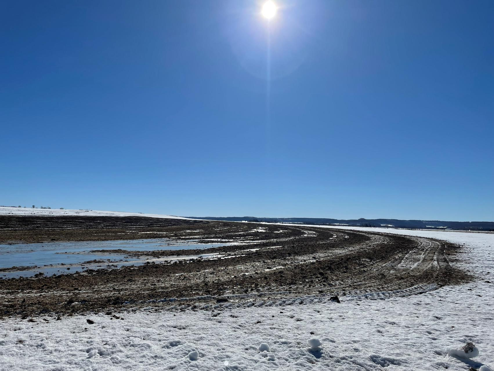
Typically, the ground is frozen or snow-covered for 100 to 140 days each Wisconsin winter. Spreading manure atop it increases the chance the material will not fully absorb into the soil. This can lead to surface runoff, which can contaminate water, spread pathogens, seed algae blooms and kill fish.
The researchers selected Wisconsin, in large part, because the state documents CAFO locations and sets hard limits on manure spreading. The department generally curbs CAFO manure application during winter and prohibits the practice outright in February and March unless operators obtain an exemption.
Wisconsin often relies upon citizen watchfulness and self-reporting to protect the environment from illegal spreading, but fields are not always visible from roadsides or neighbors omniscient. Meanwhile, state agencies with limited staff time must prioritize enforcement.
The scientists propose bolstering regulators’ efforts to monitor large livestock farms with satellite imagery and AI — tools that could, advocates hope, be used in any snowy state.
Expanding satellite fleet offers new possibilities
Scientists have used satellites and machine learning to identify CAFOs in North Carolina, trace the expansion of livestock farms in Indiana and map cropland in Wisconsin.
But previous inquiries haven’t scrutinized livestock farms in near-real time.
RegLab researchers in a 2022 study obtained images of 330 CAFO locations across Wisconsin from Planet, a San Francisco-based satellite and data company that uses a fleet of more than 150 orbiters to photograph Earth’s entire land mass. Anyone with an annual subscription — starting at $10,000 — can track thousands of acres.
The Stanford scientists used near-daily images from three recent winter seasons — when manure stands out against the backdrop of snow-covered fields — to train their model to recognize spreading. The scientists also sought to identify farms that spread more frequently than others.
Later, the researchers selected a random sample of 30 winter manure-spreading events the model detected. They discovered state filings documented only four, raising questions about the comprehensiveness of the department’s winter spreading record-keeping.
Finally, the model predicted about 700 to 1,200 instances of manure spreading during February and March 2022 when it is “presumptively prohibited.”
The study accused the state of “laxness of enforcement and monitoring,” which “has resulted in widespread winter land application.”
The researchers’ tone has since softened.
“The number itself is not super concrete,” study co-author and RegLab data scientist Nic Rothbacher said of the estimate. “Still, I agree the conclusion is right, that there is a lot more manure application happening than perhaps the state would like to see based on environmental risk.”
DNR investigates ground truth
In 2023, the RegLab researchers conducted a new assessment of the model’s accuracy by comparing it to a season of on-the-ground observations.
They forwarded to the DNR a batch of 582 potential detections captured by satellites that monitored all Wisconsin CAFOs during the two prohibited months.
Employee Ben Uvaas, who then helped oversee CAFO compliance and enforcement, handled the detections like he would a complaint of spreading spotted from a kitchen window.
From hundreds of miles above, streaks of manure resemble skid marks on Mother Nature’s toilet paper, yet other scenery can lead aerial viewers astray.
The winter spreading of waste feed and tillage — both legal — duped the model, according to a spreadsheet of outcomes obtained through a public records request. So did solar panels. In some cases, snow melted, revealing manure from previous months.
Uvaas sifted out about 75 percent of the detections. Other staff contacted farmers, reviewed CAFO records and inspected fields.
Their inquiries unearthed 30 instances of manure spreading during February and March, nine of which were deemed noncompliant. A handful of applications were performed legally because the manure originated at a non-CAFO; unlike CAFOs, smaller livestock farms generally are exempt from winter spreading rules.
Staff did not determine whether illegal spreading transpired in an additional 22 cases.
“We definitely did find more noncompliant winter spreading than a normal or an average year,” Uvaas said, pinning a typical figure at two or three. “That wasn’t surprising to me, considering the amount of time staff spent looking for them.”

The 2022 RegLab study cannot be compared side-by-side to the latest outcomes because the researchers examined only detections in which they had greater confidence and didn’t seek to generate a statewide estimate of manure spreading. However, Uvaas thinks the new observations indicate unreported winter spreading happens in Wisconsin far less frequently than the researchers previously suggested.
He is glad the department participated; employees learned “valuable lessons,” such as the need to clarify frozen manure regulations.
Yet, for all the effort staff put into the project, Uvaas said, “I just don’t think the juice is worth the squeeze to pursue this kind of technology for winter spreading issues.”
The researchers had a different take. They considered the model’s ability to detect manure without respect to legality. It correctly spotted it in about half of the 121 cases the regulators investigated.
Broadly speaking, the greatest barrier to accuracy is a dearth of winter manure-spreading images with which to train the model. Popular AI like ChatGPT can feast on pre-existing language data, but the scientists could feed their model only a limited set of manually identified examples.
Understanding the phenomena that affect the ground’s appearance from miles on high also presents a challenge. Another obstacle: Light from reflective snow cover occasionally bleached the already low-resolution images. Clouds obscured the view.
Given the uncertainties, the RegLab researchers believe authorities should use detections to prioritize cases worthy of human investigation, not function as a judge and jury.
Drawing legal lines in the sand (and snow)
Agency staff informed at least some of the farmers who spread illegally that their complaints came from eyes in the sky.
“It was very difficult and time-consuming for me, specifically, to try and convince people, no, these are not DNR satellites,” Uvaas said. “No, DNR is not flying a satellite or a drone over your farm.”
Brad Krueger didn’t know about the aerial imaging.
He milks about 770 cows at MAM Farms in Markesan, Wisconsin. In February 2023, an employee spread manure when he wasn’t supposed to, and satellites caught the results on camera.
Krueger said the knowledge that sentinel satellites could be watching wouldn’t necessarily change the way he operates. “What’s right is right, and what’s wrong is wrong,” he said.
But Krueger would prefer that a human verify all detections, a point on which he, Uvaas and the RegLab researchers agree.
“I have a problem with people sitting in an office and telling me what I should or should not do either,” Krueger added. “Because they’re not out here, 14 degrees below zero, trying to take care of animals.”
Krueger, like several farmers, said his “beef” lies more with the fairness of Wisconsin’s manure-spreading rules than the technology with which it enforces them. Some producers said it’s unfair to single out CAFOs when operators of smaller farms can apply manure with seeming impunity.
The model wasn’t designed to identify such circumstances, and it lacks a law degree.
Yet, the model’s spotting of at least 21 verified instances of permitted application during the prohibited months raises a question about the logic of state rules. Should Wisconsin lawmakers delineate legal and illegal spreading based on farm size and timing if the potential harms are the same?
The Chicago-based Environmental Law & Policy Center, which assisted RegLab in the research, calls the law’s distinctions arbitrary.
“The water doesn’t know or care where the poo came from,” staff attorney Katie Garvey said.
Will AI swamp the DNR with complaints?
The DNR has for years used satellite imagery to map things, but Uvaas doesn’t foresee adding AI to the agency’s CAFO enforcement tool belt.
Instead, he anticipates other consequential changes. Accessible satellite imaging could “swamp” the agency with citizen complaints — potentially thousands.
“I would be really surprised if this is the last time DNR is responding to complaints identified by technology that’s similar to this,” he said. “It doesn’t require DNR to pick up the technology ourselves. It’s coming to us.”
Garvey called it “unfortunate” that AI wouldn’t be used in-house.
“What I hope that DNR will be able to see is that it never has been, and never should have been, citizens’ responsibility to be monitoring what polluters are doing,” she said. “Citizens are already having to pay the price.”
The Stanford scientists don’t know if regulators in other states have tried using the technology. Doing so in Wisconsin, Uvaas said, would require cash and political appetite. However, lawmakers are just starting to grapple with AI’s impacts on elections, government administration and the workforce.
The Environmental Law & Policy Center plans to continue investigating how the model could be adopted by governments and non-government watchdog groups (acquiring aerial imagery is likely cost-prohibitive for residents, Garvey said).
Regulators could consider using the technology for goals beyond enforcement, she noted, including data collection or water quality standards development.
Some see privacy ‘gray area’
Don Weiss, of Weiss Family Farms in Durand, feels ambivalent about satellite surveillance.
A DNR employee contacted Weiss in February 2023 after his dairy operation spread solid manure on a field the week prior.
Aerial imaging seems like a violation of his privacy, Weiss said, but farmers also must comply with regulations.

“It’s such a gray area that it’s so hard to tell what is the right or wrong thing to do,” he said. “I know they need to monitor people because people try to get away with murder.”
Stanford researchers have likewise pondered privacy implications.
The initial RegLab study noted that CAFO operators already must report spreading. State and federal officials could arrive at any time to inspect a farm, and operations often sit in public view. RegLab Research Director Kit Rodolfa said that any use of satellite imagery must balance potential harms and benefits.
“We need to be thoughtful about where we think that line is,” he said. “I don’t think that’s just a decision for us as researchers to be making unilaterally.”
Zinke, the Brownsville farmer, laughed about his encounter with satellites.
In one respect, the surveillance doesn’t bother him. He, too, uses satellite technology on his farm.
But Zinke resigns himself to the scrutiny. If not a satellite, he said, something else would watch — perhaps a trespassing neighbor on a four-wheeler.
“If they want to take a picture of my field,” Zinke said, “I ain’t got nothing to hide.”
The nonprofit Wisconsin Watch (www.WisconsinWatch.org) collaborates with WPR, PBS Wisconsin, other news media and the University of Wisconsin-Madison School of Journalism and Mass Communication. All works created, published, posted or disseminated by Wisconsin Watch do not necessarily reflect the views or opinions of UW-Madison or any of its affiliates.

Wisconsin Public Radio, © Copyright 2026, Board of Regents of the University of Wisconsin System and Wisconsin Educational Communications Board.