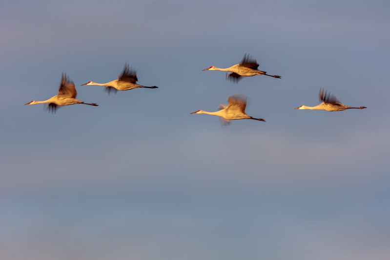
A University of Wisconsin-Stevens Point graduate student is using drones with thermal cameras to transform how scientists monitor waterfowl populations and protect Wisconsin’s wetland habitats.
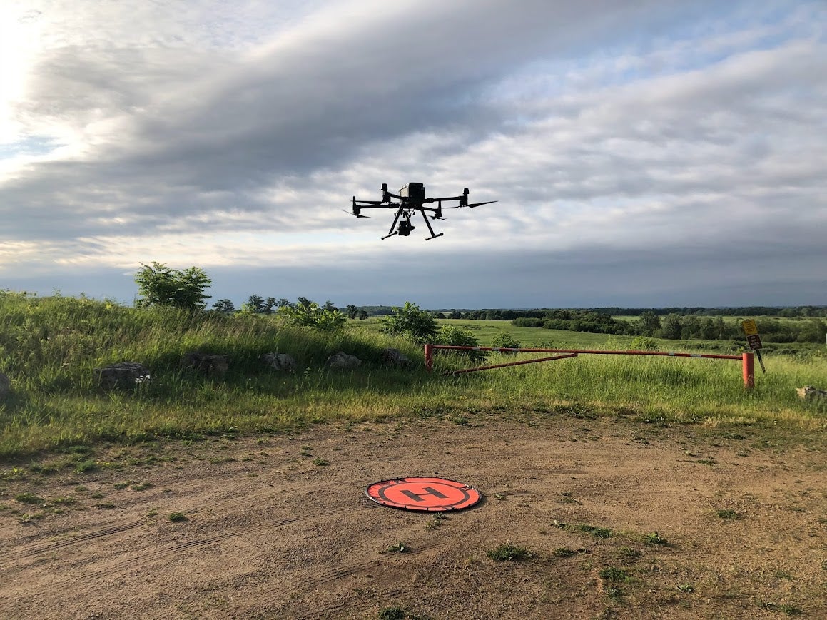
Amanda Griswold recently wrapped up a two-year study examining the effectiveness of uncrewed aerial systems in surveying breeding waterfowl across Wisconsin’s diverse wetlands. The project, supported by a Wisconsin Department of Natural Resources grant and other conservation organizations, tested how drones could enhance detection rates, reduce disturbance to wildlife and support more precise habitat restoration strategies.
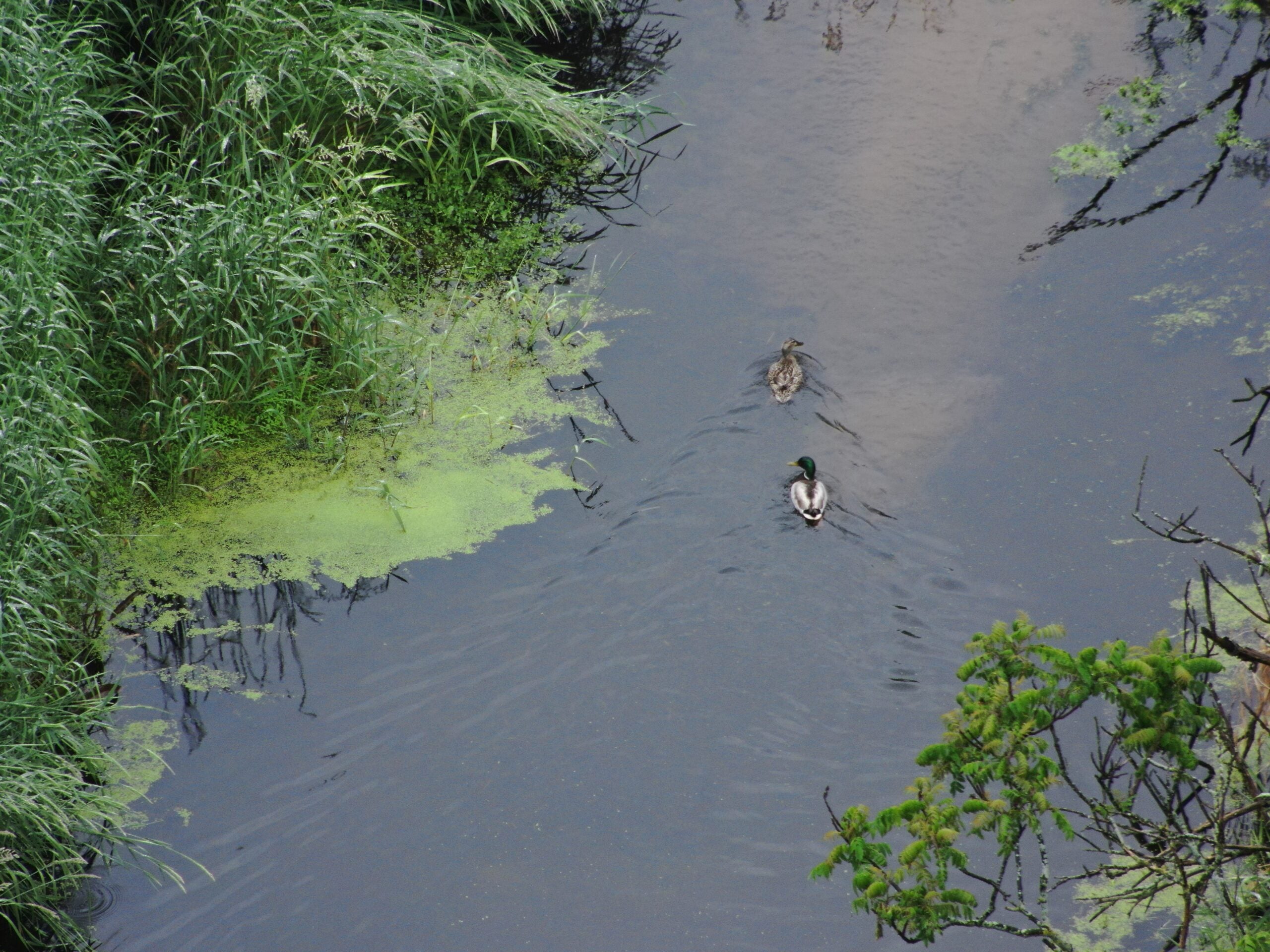
Using drones outfitted with high-resolution thermal imaging, Griswold and her team identified hundreds of waterfowl broods and breeding pairs, even in dense vegetation where birds often go unnoticed during conventional surveys.
News with a little more humanity
WPR’s “Wisconsin Today” newsletter keeps you connected to the state you love without feeling overwhelmed. No paywall. No agenda. No corporate filter.
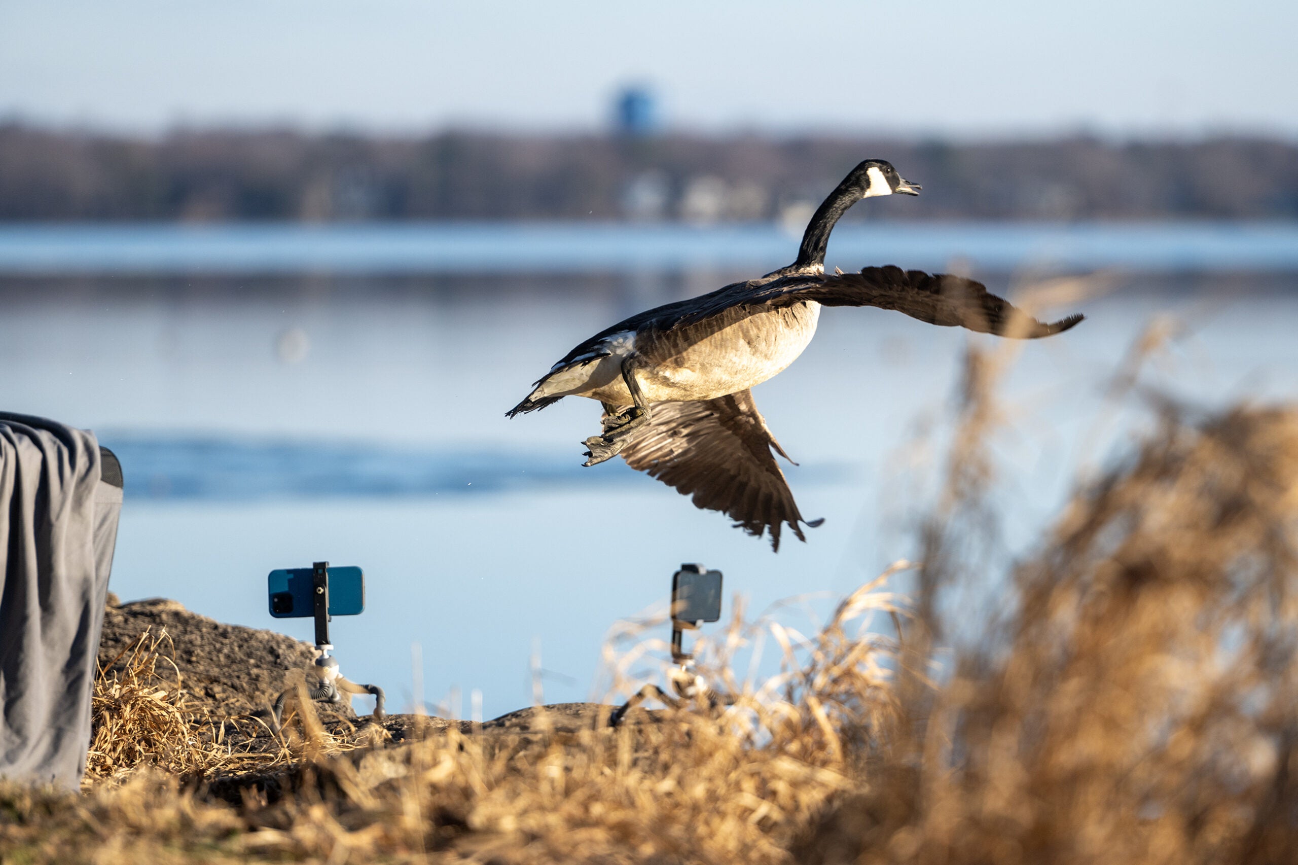
In a conversation with WPR’s Shereen Siewert on “Morning Edition,” Griswold said drone technology can be more efficient and less invasive, allowing researchers to observe wildlife without disrupting natural behavior.
“Just the sound of people walking through the grass or around in a boat can cause birds to act unnaturally or to flush and swim away,” Griswold. “With drones, because we can fly so high in the sky and still zoom in to see them, we see fewer disturbances.”
The work has implications beyond Wisconsin. With drone surveys already being adopted in parts of the U.S. and internationally to track species ranging from elephants to marine mammals, Griswold’s findings contribute to a growing body of knowledge about how aerial monitoring can support wildlife management on a broader scale.
The project illustrates a growing trend in conservation science: using data-driven tools to make smarter, faster decisions in the face of environmental change.
The following interview was edited for brevity and clarity.
Shereen Siewert: How did you come to fly drones? Did the interest in drones or waterfowl research come first?
Amanda Griswold: I was more interested in waterfowl research. I love to fly in actual planes, and I also love ducks. Both of those two are combined into one project, which really interested me. That’s what drove me to apply and participate.
SS: What is the most exciting thing you discovered?
AG: This technology is really new in wildlife research, especially when we first started this project in 2022. Just the fact that we were able to complete this project successfully and count all the ducks is incredible. I wasn’t really sure what to expect when we started, and it was exciting to see the project work out. That doesn’t always happen with wildlife research.
SS: What advantages do drone surveys offer compared to traditional ground or aerial methods?
AG: Those traditional aerial methods are usually done in either airplanes or helicopters, and the ground surveys are either on foot or in a boat or some other type of watercraft. And both of those options can be pretty expensive. Although the initial cost of the drone can be expensive, you’ll save money in the long run by saving time.
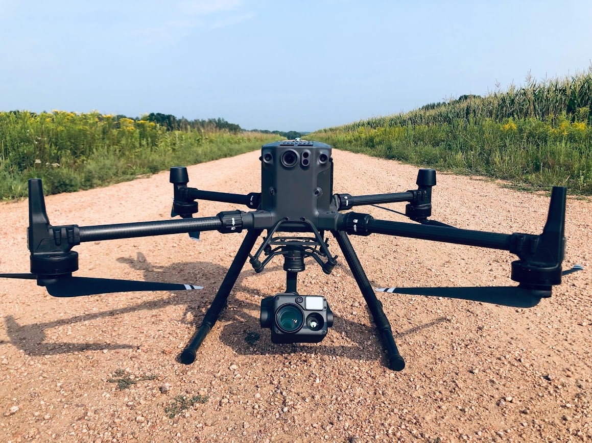
With the thermal cameras, we’re able to count birds a lot easier than you could on the ground or from the sky. Birds like to hide within the vegetation, but we can use that thermal camera and still spot these birds. That’s something that you wouldn’t normally be able to see on the ground, or up so far in the sky. The cameras allow the birds to pop out to us on the screen, which can improve the population estimates we have of them.
It’s part of a much larger project, called the Wisconsin Waterfowl Habitat Conservation Strategy. Essentially the strategy assigns priority levels to watersheds in Wisconsin, ranging from one to nine. We wanted to survey all different types of habitats, both good and bad, and we wanted to choose sites that had both upland and wetland landscapes, which are both important for breeding waterfowl.
SS: Do you feel like this technology could be scaled up to monitor other species or be used in different regions of the country?
AG: Absolutely. It’s already actually being used to survey wildlife species other than ducks. It’s being used in other countries to survey elephants or other large mammals. It’s being used in the United States to survey deer, marine mammals, and a lot of other different types of bird species, too.
SS: How do you see this research influencing how the Wisconsin Department of Natural Resources or other agencies manage waterfowl populations in the future?
AG: Going back to the traditional survey methods with those aerial and ground surveys, usually they’re paired together. Right now, the DNR conducts a waterfall breeding population survey every spring. They fly in airplanes across different transects throughout the state.
Then, because you can’t see every bird with aerial surveys, they send out ground observers to some of these same sites to count birds on the ground and use that as a correction factor to determine how many birds are actually there. One way that drones can improve this method is that instead of using ground observers, there is a potential to use drones instead and save money and time, while finding more birds.
SS: What kind of challenges did you face collecting or analyzing the data?
AG: One issue is battery life. We can only fly the drones for about 45 minutes before we have to land them to replace the battery. If you’re flying at a site that takes more than three sets of batteries, you have to charge your batteries out in the field. We would have to carry generators with us to charge these batteries, and it can take a lot of time.
Another issue that is specific to Wisconsin is that we have a lot of trees. When you fly a drone, it is a requirement that the drone remains in sight, so you can’t fly behind the trees. That can limit the area you can survey while seeing the drone. And if you do fly behind the tree, it can disrupt your connection with the drone, which also causes issues. You can’t control the drone if you lose connection with it. It’s definitely easier to use these drones in a more open habitat.
SS: What’s next for you moving forward?
AG: We officially wrapped up the project at the end of February of this year. It has been a little difficult to get a job working in natural resources at this moment, but we’re also working on publishing this research. In the meantime, I am just working on writing up some papers on this to try and get the news out there.
If you have an idea about something in central Wisconsin you think we should talk about on “Morning Edition,” send it to us at central@wpr.org.