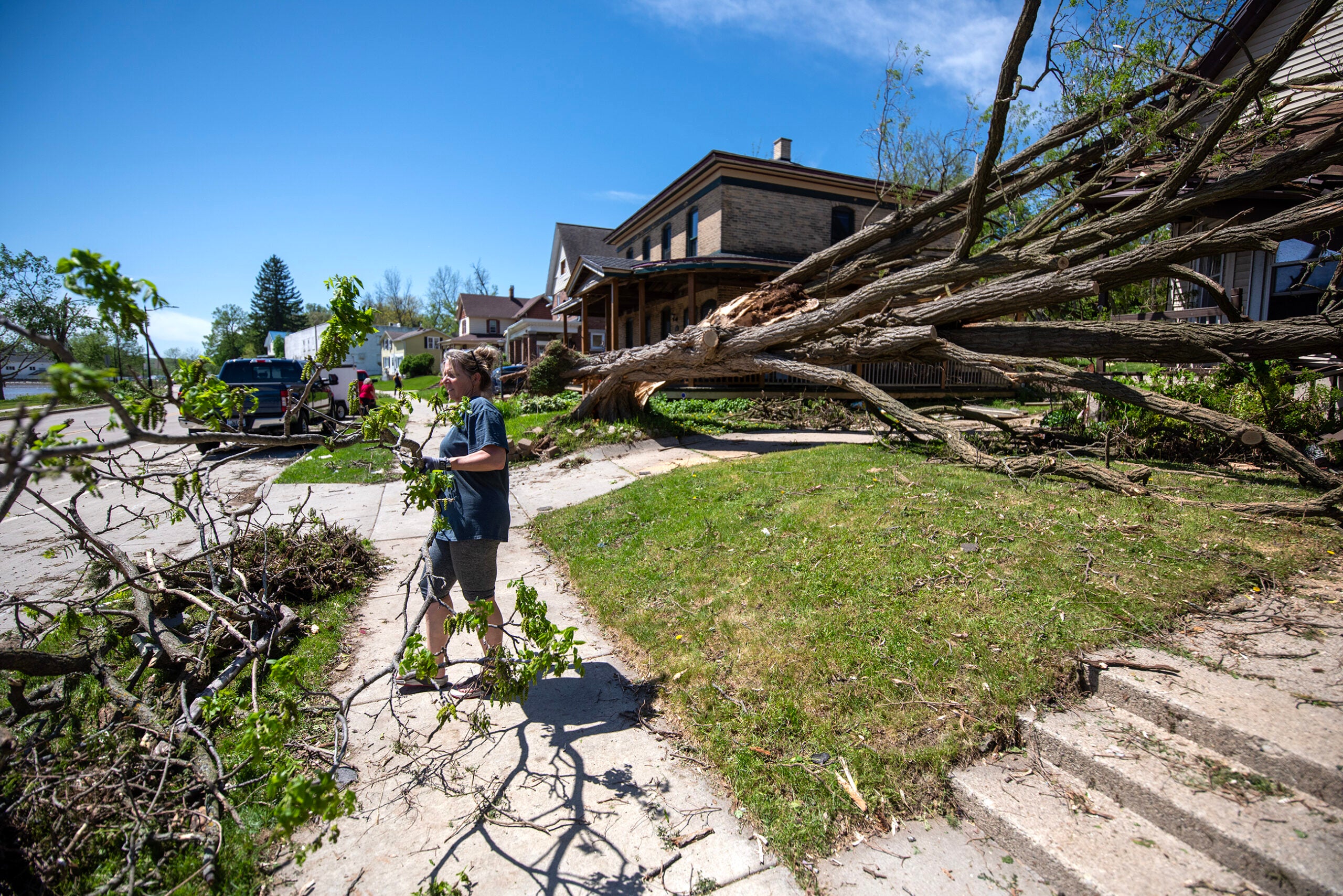
Severe storms moving across the state had knocked out power for more than 100,000 utility customers in Wisconsin as of 9 p.m. on Wednesday.
Power was out for more than 46,000 We Energies customers, more than 48,000 WPS customers, more than 21,000 Alliant Energy customers and about 15,000 customers served by members of the Wisconsin Electrical Cooperative Association.
Storms began in the western part of the state Wednesday afternoon, including at least one confirmed tornado near the Tomah area around 4 p.m., according to the National Weather Service in La Crosse.
News with a little more humanity
WPR’s “Wisconsin Today” newsletter keeps you connected to the state you love without feeling overwhelmed. No paywall. No agenda. No corporate filter.
We can confirm that this tornado is on the ground! Take shelter in the Tomah area! https://t.co/xrDMkxv9gb
— NWS La Crosse (@NWSLaCrosse) June 15, 2022
Earlier in the day, La Crosse Meteorologist Jeff Makowski said thunderstorms would develop near the Mississippi River and spread east across the state into the evening.
Some of those storms have been severe, producing hail, strong winds, torrential rainfall and tornadoes. A majority of the state was under a tornado watch just before 5 p.m.
Makowski says residents should remain vigilant.
“This is one of those days, where we encourage everyone to make sure they have a safety plan in place. To have a shelter that they can go to quickly should storms approach,” Makowski said. “We also encourage everyone to keep an eye on weather conditions, make sure they have multiple ways to access warnings should they be issued, and then to take timely action.”
The Rock County Sherif’s Office recommends people decide where to shelter, and to consider pets and livestock as well.
In a press release, the office listed a series of ways to prepare for severe weather including: charging electronics, creating a “go bag” and avoiding travel if possible.
While storm fronts may lower some temperatures across the state, high heat and humidity is likely to remain in the eastern and southern parts of the state until at least Thursday, Makowski said.
“We’ll have one more hot day today ahead of the thunderstorms,” Makowski said. “We’ll go into a slightly cooler weather pattern here over the next few days, at least tempering the heat and the humidity somewhat. … But then it does look like the heat will start to build back into the state late in the weekend into early next week.”
Public Health Madison & Dane County tweeted for residents to be “weather aware” Wednesday as extreme heat poses a risk for vulnerable residents.

Wisconsin Public Radio, © Copyright 2025, Board of Regents of the University of Wisconsin System and Wisconsin Educational Communications Board.