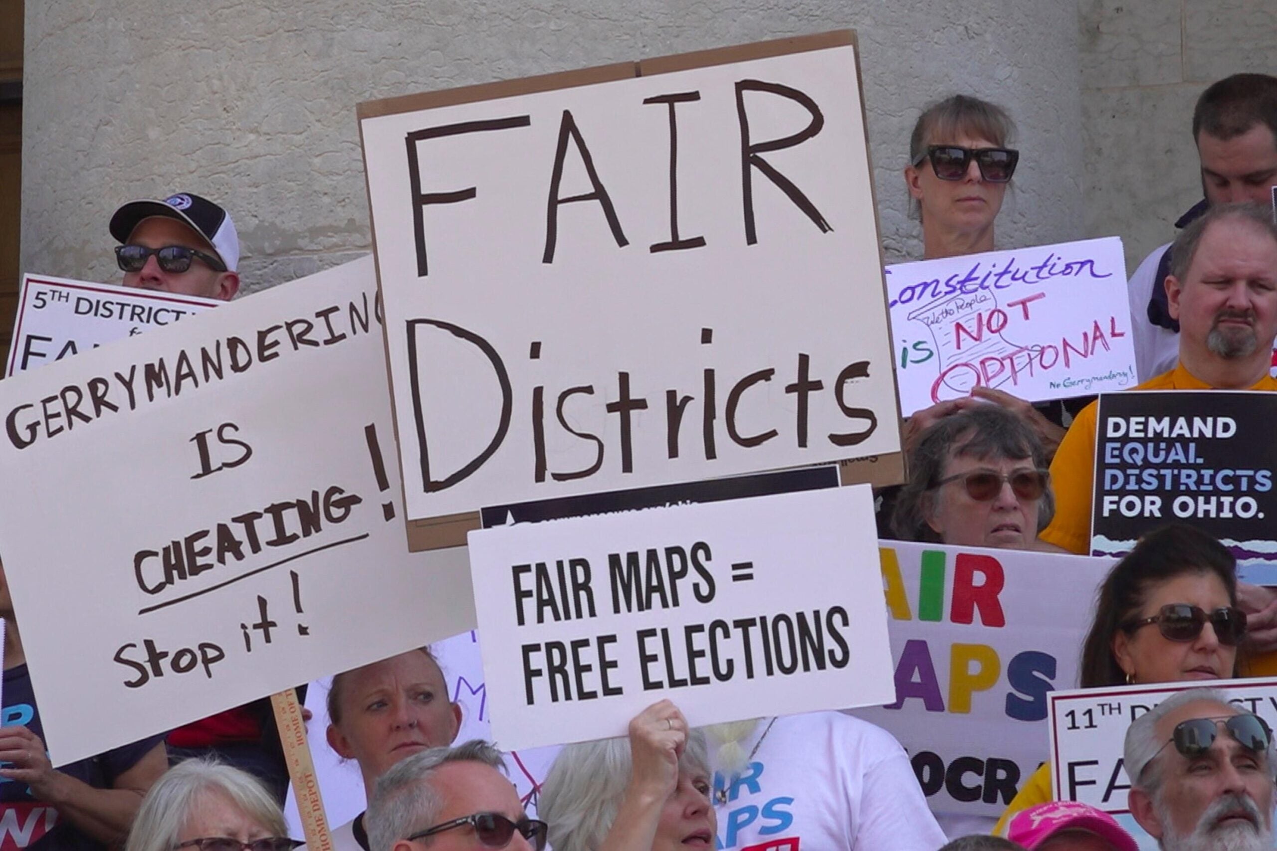
By the time Wisconsin’s new political district maps were passed in 2011, Republican Dale Schultz had been in the Legislature for nearly 30 years. Like generations of Wisconsin lawmakers before him, he’s seen the pendulum of power swing. In the Senate, where he spent most of his career, he’s seen control flip back and forth seven times.
He has been through three cycles of redistricting, with the last two under divided government.
“There was a check and balance,” he said. “And that forced some compromises.”
But in 2011, things were different. Republicans controlled the governor’s office, the state Senate and the state Assembly, giving them control over the entire redistricting process.
When GOP leaders and their lawyers set up shop at a private law firm across the street from the Capitol, Schultz was one of the rank-and-file Republican lawmakers who visited to look at the new boundaries of his district. He signed the confidentiality agreement and voted for the map. At the time, he said he didn’t think much about it, until the next election.

Retired Republican state Sen. Dale Schultz at his farm near Richland Center, Wis. Bridgit Bowden/WPR
On Nov. 6, 2012, President Barack Obama won a second term in the White House. In Wisconsin, his victory was decisive. He defeated Republican Mitt Romney by more than 200,000 votes.
This spilled over to races down the ballot, with Democrats receiving more than half of the votes across all state Assembly races.
“It was, you know, pretty much a Democratic landslide,” Schultz said. “We got wiped out. And then somebody said to me, ‘Well, don’t worry … we’re still in control of the Assembly.’”
Despite receiving fewer than 50 percent of the total votes, Republicans won 60 out of 99 seats in the Wisconsin Assembly and preserved their majority in the state Senate, too.

Map data courtesy of the Legislative Technology Services Bureau/John K. Wilson/WPR
Schultz said he couldn’t figure it out. The math didn’t add up. In such a Democratic year, he expected Democrats to win in the Legislature, too.
“And it was at that point that the light switch went on, and I realized what a mousetrap had been built,” he said.
Schultz realized it was the map. Republicans had drawn legislative district lines that protected them, even when Democrats performed better. Schultz and the state of Wisconsin had seen the 2011 map in action.
A pattern emerges
The map that Schultz saw in action was the result of countless decisions by mapmakers: where to draw a line, what shape to make a district. If you step back for a minute — and look at the whole map — a pattern emerges. In the big picture, the decisions benefit Republicans.
Sometimes, this looks like breaking up a community, or “cracking” it into multiple districts. That’s what happened in DeForest, a village about 30 minutes north of Madison, where lots of its residents work.
Before 2011, the village of around 10,000 people was represented by one representative and one senator. After the new map, it got considerably more complicated.
DeForest resident Abby Lowery remembers when she learned about the changes because one of the dividing lines went right in front of her house.

Abby Lowery in DeForest, Wis. Her village is split into three Assembly districts and three Senate districts. Angela Major/WPR
Lowery had heard about a bill being pushed at the state Capitol that would have allowed for the sale of water utilities to private companies.
“And so that kind of set alarm bells off in my head,” Lowery said, remembering the water crisis in Flint, Michigan. “I had two little kids at the time, I think they were like four and one. And I was very concerned about that.”
Lowery said she didn’t hear anybody in town talking about the bill, so she set out to change that. She made fliers to hand out to her neighbors encouraging them to contact their elected officials.
But, there was a problem. Because she lived on a district line, some of her neighbors had different representatives. As she was looking at the district map she realized DeForest wasn’t just split in half. It was split into three Assembly districts and three Senate districts. There were six different lawmakers representing the village.

John K. Wilson/WPR
But more lawmakers for DeForest doesn’t necessarily mean more political sway.
Lowery, who’s now on the village board, said the village’s legislators don’t often come to parades or public meetings because they consider other communities home.
“I strongly feel if we were all in one district, like one Assembly district, one Senate district, I think that person would show up,” Lowery said. “I don’t know how they couldn’t.”
Because DeForest is such a small part of each of their districts, Lowery said, it’s like an afterthought. Instead of more power, DeForest has less.
A swing district no more
Two and a half hours northwest of DeForest is Eau Claire, a city of about 70,000 people. Eau Claire is too big for a single Assembly district. It has to be divided up somehow.
Before 2011, the city was more or less split between north and south. In the north, there was one Assembly district and one Senate district, and in the south, the same.
All of these districts included some parts of the city and some rural areas, which made a lot of sense to Eau Claire resident Wendy Sue Johnson.
“Eau Claire is a two-high school town,” Johnson said. “It’s a two-zip code town. It has two rivers going through it that makes it very clear when you’re on one side of town versus the other.”

Wendy Sue Johnson outside her office in Eau Claire, Wis. She says the district where she unsuccessfully ran as a Democrat for Assembly in 2018 is too gerrymandered to be competitive. Angela Major/WPR
Johnson describes herself as a lifelong northsider, and she’s pretty political. She was on the school board, and in 2018, she ran as a Democrat for the state Assembly.
She said before 2011, Assembly and Senate races in the area were really competitive.
“It would swing with the mood of the electorate,” she said. “So if there’s a nationwide Democratic wave, or nationwide Republican wave, that usually would play out in western Wisconsin, and that has not happened since 2010.”
The numbers bear that out. The four districts that used to represent Eau Claire were amazingly close.
In 2006, for example, Democrat Pat Kreitlow won the old Senate district that included the north side of Eau Claire by less than 2 percentage points.
In Eau Claire’s Assembly races that same year, Republican Terry Moulton won the northside district by 2.5 percent, while Democrat Jeff Smith won in the south by about 1 percent.
The seats would swing back and forth. Moulton lost his 2008 Assembly race to Democrat Kristen Dexter by less than 1 percent before Kathy Bernier won it back for Republicans in 2010 by a razor-thin 92 vote margin.
Smith held his seat for just two terms before Republican Warren Petryk beat him in 2010 by just 74 votes out of more than 22,000 cast.
With both Assembly and Senate seats up for grabs almost every election, candidates had to fight for every vote.

John K. Wilson/WPR
In 2011, Republican mapmakers changed that. They drew one Assembly district that covered most of the city of Eau Claire. On the map, it looks sort of like a bullseye — one small urban district surrounded by much bigger, rural districts.
Unlike DeForest, which saw itself “cracked” into several pieces, the city of Eau Claire’s votes and its Democratic base were “packed” into one.
The results have been consistent in the elections ever since. The urban district is very Democratic while the surrounding rural districts lean heavily Republican.
Johnson found this out when she ran for the Assembly in 2018. She knew she faced long odds, but she wanted to give people a choice in the election.
And in a year that saw Wisconsin elect Democrats for governor, U.S. Senate and every other statewide office, Johnson lost her race badly, by about 15 percent.
Johnson had seen enough. She said she would never run for office in this district again.
“Not on gerrymandered maps,” she said.
Before the new map, Eau Claire was perhaps the most competitive area of Wisconsin. It could swing back and forth any given election and swing control of the Legislature. Under the new map, people like Johnson say it’s not even worth running. These races are predetermined.
‘My vote doesn’t count’
Wisconsin’s biggest city, Milwaukee, is one of the most complicated parts of the map, partially because so many people live there.
Helen Harris, a Democrat, lives on the northwest side of the city, in a house that she and her husband built.
When Republicans drew the map in 2011, they created a number of Assembly districts that stretched from the edge of Milwaukee westward, into the city’s Republican-dominated suburbs.
So some Milwaukee Democrats like Harris suddenly found themselves with very conservative representatives who did not call Milwaukee home.
“We were kind of chopped off and added to a heavily Republican district that stretched out throughout the city and a couple of other counties,” Harris said.

Helen Harris at her home in Milwaukee, Wis. Because of the way her Assembly district was drawn, she says, “My vote doesn’t count.” Angela Major/WPR
A couple of these districts are competitive, but not Harris’. In the last election, the Republican candidate, Menomonee Falls Republican Rep. Janel Brandtjen won unopposed.
Harris said she feels like her new representatives have been constantly at odds with the city she’s proud to live in.
“There also seems to be a lot of distrust in some Republican districts about the city, and a lot of hatred of Milwaukee,” Harris said.
It’s important to note that these lines need to go somewhere. Harris lives just blocks away from a Democratic district with a representative who shares her views. Someone is always going to be on the edge of that line.
Wisconsin Public Radio, © Copyright 2026, Board of Regents of the University of Wisconsin System and Wisconsin Educational Communications Board.