Partners working to clean up a polluted hotspot on Lake Superior are now looking to monitor emerging threats from harmful algal blooms.
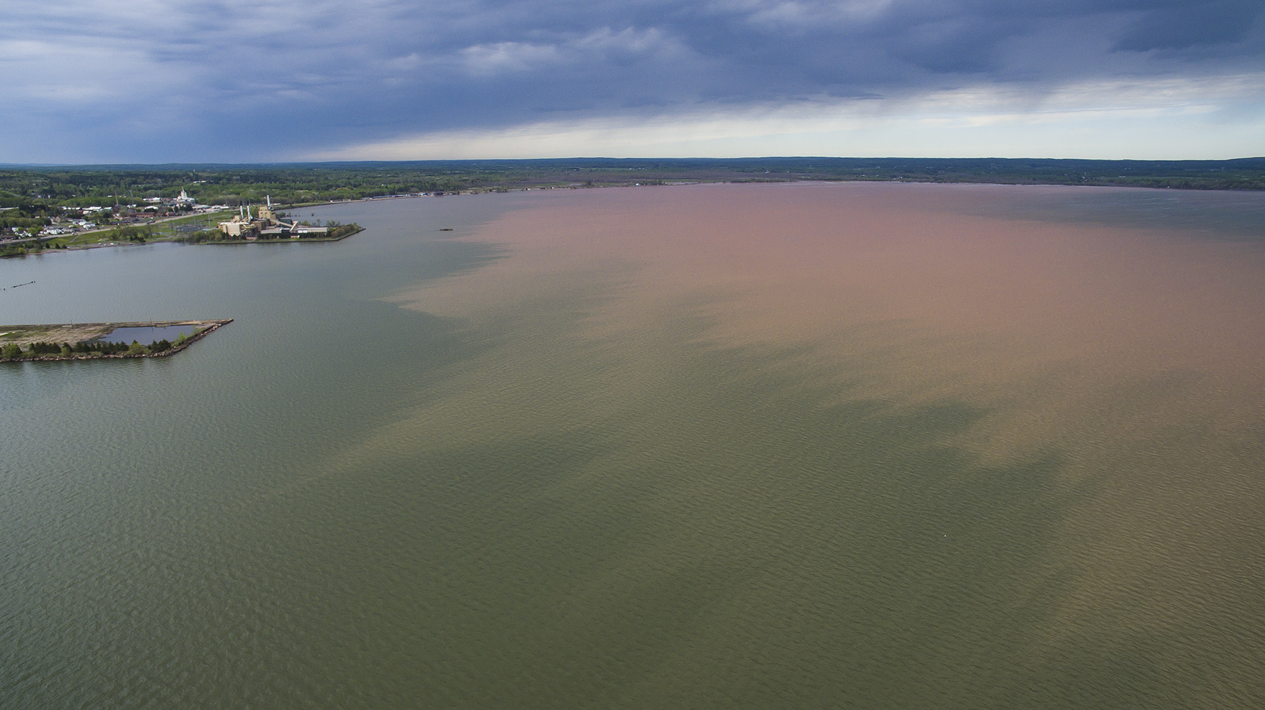
The St. Louis River, which separates Superior and Duluth, is the largest tributary to Lake Superior, and it flows into a 12,000-acre freshwater estuary. In 1987, the site was one of 43 places designated as an “area of concern” under the Great Lakes Water Quality Agreement because of severe contamination.
Over a century ago, industrial and shipping practices on the waterfront contaminated the river with mercury and other toxic chemicals. In the last several decades, partners working to clean up the river have made significant progress. They have a goal to wrap up work on the river by the end of the decade.
News with a little more humanity
WPR’s “Wisconsin Today” newsletter keeps you connected to the state you love without feeling overwhelmed. No paywall. No agenda. No corporate filter.
As they look forward, a team of scientists is now deploying sensors to collect more than 300 water samples from the St. Louis River Estuary to track emerging water quality issues.
“We need to set up a monitoring plan that’s focused on the problems we’re seeing now — harmful algal blooms, excess nutrients in specific locations,” said Euan Reavie, senior research associate with the Natural Resources Research Institute at the University of Minnesota-Duluth.
The sampling will take place this year and next with the help of a roughly $400,000 grant from the National Estuarine Research Reserve System Science Collaborative. It’s part of an effort to fine-tune where and how often to conduct sampling to track changes over time. The project is being spearheaded by the Lake Superior National Estuarine Research Reserve and the Natural Resources Research Institute.
Hannah Ramage, monitoring coordinator at the research reserve, said they’re deploying devices called sondes underwater at four sites in the river. The instruments have a set of sensors that take readings every 15 minutes on things like temperature, acidity and dissolved oxygen. Those are important parameters for determining the health of a waterway.
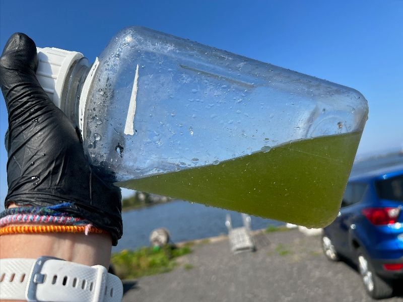
“On top of that, we are going out and collecting water samples for processing almost weekly throughout the open water season and then also in the wintertime,” Ramage said. “So those physical samples that we’re collecting, putting in bottles, and bringing back are being analyzed for nutrients. We’re also looking at the phytoplankton community.”
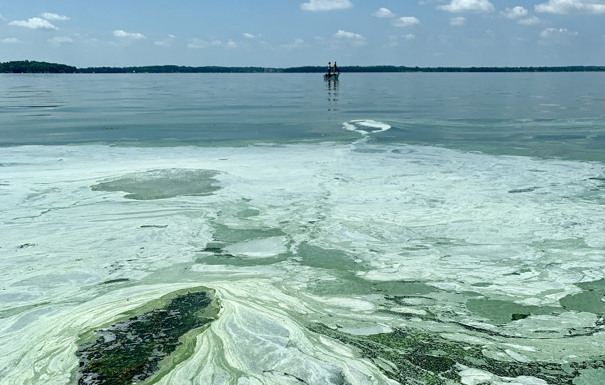
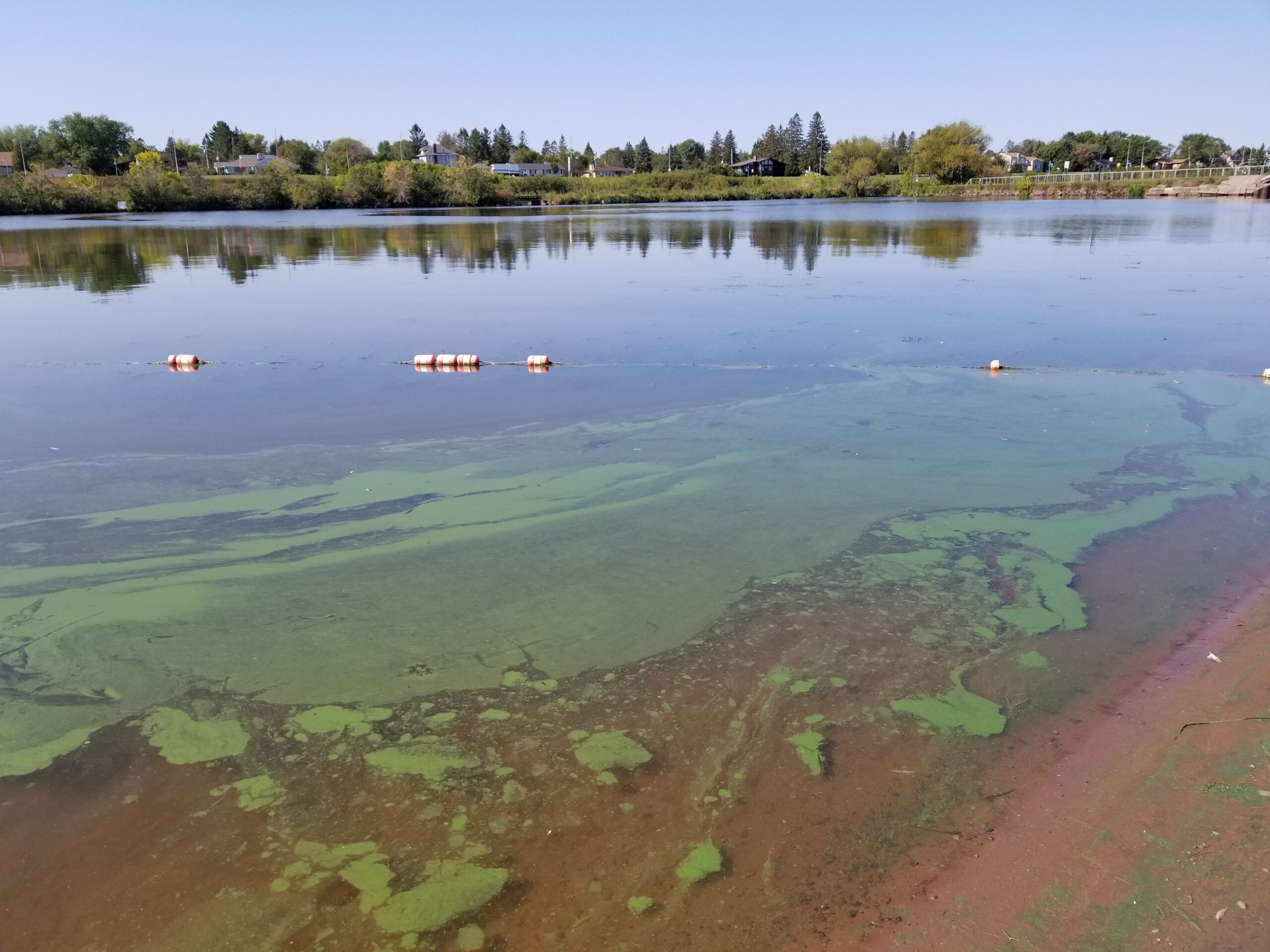
Reavie said phytoplankton represent the algae that live in open water and raise concerns about the potential for blooms to form. Sometimes they can lead to toxic blue-green algal blooms. Most harmful blooms that can make people and animals sick are caused by phytoplankton, according to the Centers for Disease Control and Prevention.
One of the devices that will continuously collect water quality readings will be located at Barker’s Island in Superior. That’s where researchers have found harmful algal blooms in recent years.
Reavie said one of the main goals is to understand why blooms have been forming in the harbor and along the south shore of Lake Superior.
“They may be related to storms. They may be related to temperature, so we’re collecting all of this information simultaneously,” Reavie said. “That’s something we need to figure out by all of this simultaneous monitoring.”
Researchers are working with multiple state and federal partners, including the U.S. Environmental Protection Agency, Minnesota Pollution Control Agency, and the Wisconsin Department of Natural Resources. They’re also working with the Fond du Lac Band of Lake Superior Chippewa in Minnesota.
Nancy Schuldt, the tribe’s water projects coordinator, said the tribe has its own water quality standards under the Clean Water Act that are more protective than Minnesota’s standards. The tribe has five permanent monitoring sites on the river within its reservation.
She said they’re supporting the research reserve’s work to determine water quality within the St. Louis River Estuary. As part of that, they’re coordinating to provide consistency in data collection.
“The incoming nutrients include what is coming down the main stem of the river, as well as what is running off from developed lands and impervious surfaces, and then all of the streams and rivers that feed directly into the estuary,” Schuldt said.
Schuldt said protecting those water resources is incredibly important to the Fond du Lac tribe, whose members originally lived in villages all around the estuary prior to European settlement. The Treaty of 1854 established the tribe’s reservation upstream in the watershed. It also reserved their rights to hunt, fish and gather in the estuary.
“There are still important and significant cultural and historic places throughout the estuary from Wisconsin Point and Indian Point and Spirit Island and the Grand Portage that goes up through Jay Cooke State Park,” Schuldt said. “This is all an incredibly significant cultural landscape for the Fond du Lac Band.”
Researchers say they’ve already begun water sampling and will continue collect samples almost weekly until October. Ramage said they’re oversampling to determine the most efficient way to conduct water quality monitoring for decades to come.

Wisconsin Public Radio, © Copyright 2026, Board of Regents of the University of Wisconsin System and Wisconsin Educational Communications Board.