In June of 2008 the Wisconsin Dells and Baraboo area were hit with storms that destroyed homes, disrupted the area’s tourism industry and caused Lake Delton to empty out into the Wisconsin River.
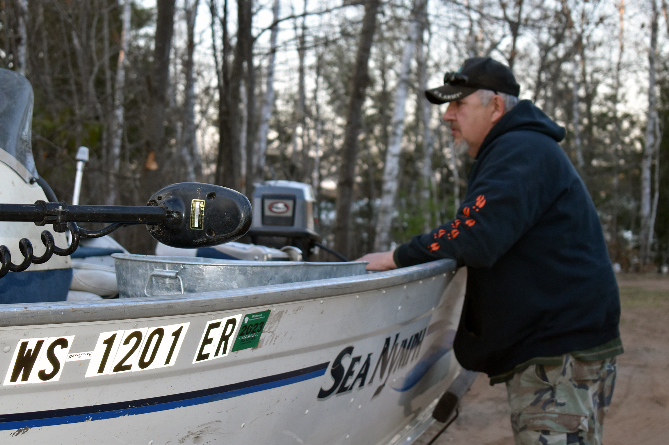
“We are looking out over the lake and we see these houses tumbling in and it was just the more surreal thing because our lake was gone,” recalled Dawn Baker, who owns the Sunset Bay Resort on the shores of Lake Delton. “It was early June, our season had just started and our lake, like our best friend, was gone, and it was just the scariest thing ever.”

Dawn Baker, owner of the Sunset Bay Resort on the shores of Lake Delton. Scott Gordon/WisContext
News with a little more humanity
WPR’s “Wisconsin Today” newsletter keeps you connected to the state you love without feeling overwhelmed. No paywall. No agenda. No corporate filter.
Nearly a decade on, in the summer of 2017, floods struck communities across Wisconsin, from Racine County to Minocqua. They left behind long-term consequences and underscore what researchers predict the Upper Midwest will face as climate change makes the region warmer and wetter in years to come.
The challenge is in making that prediction seem real.
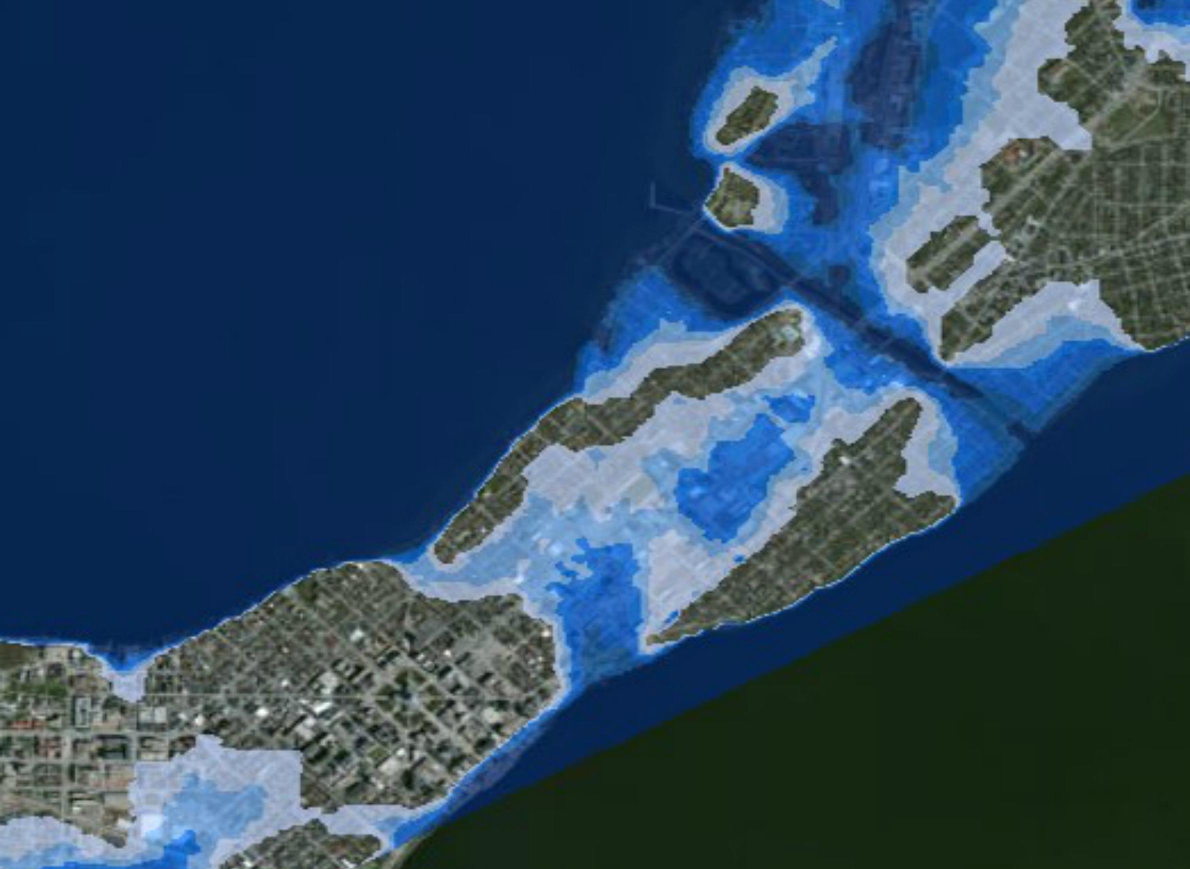
Instead of making projections about hypothetical storms, a research group at the University of Wisconsin-Madison thought the solution might be to show people what could happen if a real storm from the recent past happened somewhere else — a storm like the one that drained Lake Delton in 2008.
Ken Potter, professor of civil and environmental engineering, and David Liebl, an engineering and professional development professor, began working with students in 2012 to create a computer model of the Dells flood. But they moved the storm just a little ways to the south — to Madison.
They call it “storm transposition.”
It’s tough to predict exactly what would happen if the 2008 Dells flood happened in central Madison. In a worst case scenario, the model found that such a flood would cause Lake Mendota to overflow its banks, flood large portions of downtown, and close down the Dane County Regional Airport.
“The results would have been devastating,” said Potter, who is now retired, as is Liebl.
Potter wanted to get people’s attention. He also hoped the models would help emergency officials and city engineers think about how to bolster their city’s infrastructure and emergency plans. By identifying some weak points, a city could do more to prevent catastrophic events like a dam breaking.
“Climate change is going to increase the intensity and amount of rainfall,” Potter said. “We don’t know the details but we know that these things will increase. The real issue is, how do you get decision makers to act with that information?”
For Potter, the model isn’t just about making people accept the realities of climate change. It’s about the choices that people can still make to adapt.
“I think it’s a recognition that the climate’s changing, we also are urbanizing, we have to de-urbanize better and keep in mind how (the) climate’s changing, and it’s an uphill battle,” he said.
To some extent, cities are stuck with decisions made decades ago. Greg Fries, an assistant city engineer for the City of Madison, said large portions of central Madison are prone to flooding, and it’s hard to go in and put in new storm sewers that could carry away more water.
“In the downtown area we are largely living with a system that was designed, in some cases, almost 100 years ago or more, actually,” Fries said.
As the city expands with new development, though, it can build better storm sewers, Fries said. Madison can also require buildings in flood-prone areas to have higher foundations, among other things.
The big lesson for Potter is that while people can’t control rainfall, they still have a lot of say in where rainwater ends up.
“A thing I’m hoping (city planners and developers) are learning is that also contributing to increased flooding is urban development,” Potter said. “If we convert the landscape from soil, agricultural soil, to rooftop, to street, to parking lot, we’re going to gradually increase the amount of runoff.”
Researchers like Potter caution that a computer model can only predict so much. But the floods of 2017 have driven home the reality of climate change and a wetter world.
This story is part of a yearlong reporting project at WPR called State of Change: Water, Food, and the Future of Wisconsin. Find stories on Morning Edition, All Things Considered, The Ideas Network and online.
This report was produced in collaboration with WisContext, a service of WPR, Wisconsin Public Television, and UW Cooperative Extension. Learn more about this issue at wiscontext.org.

This report was produced in a partnership between Wisconsin Public Radio, PBS Wisconsin and the University of Wisconsin Cooperative Extension. @ Copyright 2026, Board of Regents of the University of Wisconsin System and Wisconsin Educational Communications Board.