
A new National Weather Service alert system went into effect Monday across the country that will categorize severe thunderstorm warnings based on their levels of threat and potential damage to affected areas.
Severe thunderstorm warnings will continue to be issued as they always have been, said Kurt Kotenberg, the warning coordination meteorologist at the National Weather Service office in Green Bay. But with this alert system, the National Weather Service is providing information about the severity of each storm and how likely it is to cause significant damage.
Alerts for a severe thunderstorm will be categorized as: base, considerable or destructive.
News with a little more humanity
WPR’s “Wisconsin Today” newsletter keeps you connected to the state you love without feeling overwhelmed. No paywall. No agenda. No corporate filter.
- Base: This type of warning is the minimum criteria required for the National Weather Service to issue a severe thunderstorm warning. It requires 1-inch quarter-sized hail and/or 58 mph winds. Warnings without a “tag” can be presumed to be a base-level severe thunderstorm.
- Considerable: A storm with a bit more intensity, this tag will be added to severe thunderstorm warnings when there’s at least 1.75-inch golf ball-sized hail and/or 70 mph winds.
- Destructive: Storms with 2.75-inch baseball-sized hail and/or 80 mph winds will activate this tag, indicating the highest damage threat.
Kotenberg said that if a storm looks like it will bring destructive-level damage, an automatic Wireless Emergency Alert (WEA) will be sent to all smartphones within the affected area. WEAs will not be sent for storms tagged as base or considerable levels.
The change is meant to reach more people with the tools they regularly use, in this case smartphones, instead of relying on less popular ways of reaching the public such as weather radios, Kotenberg said.
“Basically our goal is to try to reach as many people as we can with the warning to protect as many people as we can,” he said. It also will help to get information to meteorologists quickly who can then pass that information onto viewers.
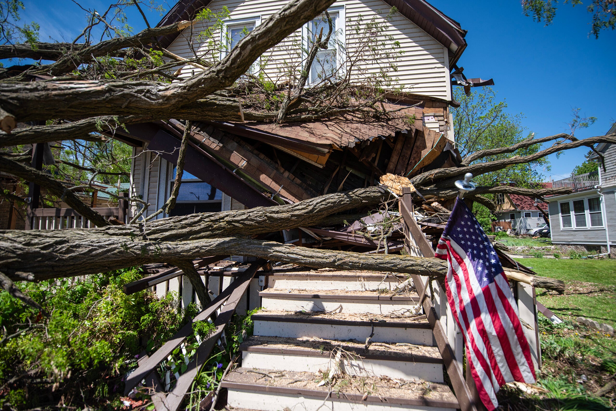
He said the hope is that people take destructive-level thunderstorms as seriously as tornado alerts, especially because of the damage that can be done by straight-line winds, which are winds with no rotation.
“We’re really trying to communicate that the 80 to 90 mph winds — that is a weak EF1 tornado,” he said, noting that it could be even more damaging than a tornado because those winds can cover much broader areas.
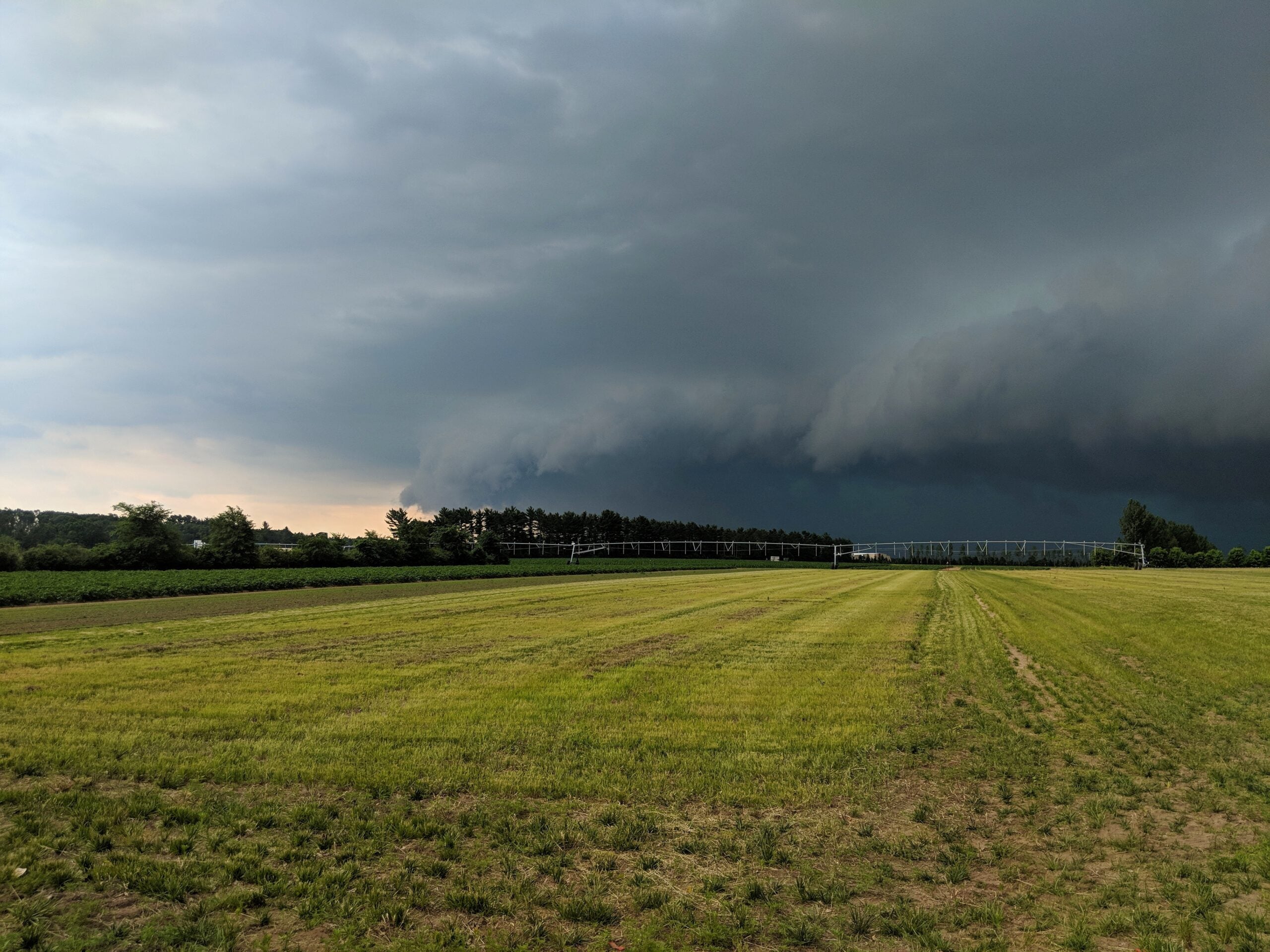
The Weather Service reported that in 2020, severe thunderstorms were the source of 13 of the 22 costliest weather-related events.
The text alerts join an array of warnings including those displayed and broadcasted on weather.gov, NOAA Weather Radio and the Emergency Alert System, among others.
Several of the storms that ripped through Wisconsin last week would have met the criteria for being a destructive thunderstorm. Kotenberg said as part of a damage survey he did in Winnebago County, he witnessed trees uprooted all over where wind speeds were between 80 and 90 mph.
“Those types of warnings were the ones that would have triggered the special wireless emergency alert,” he said. “That just would have given the people in southwest Winnebago County that additional heads up that they need to take shelter.”
More information about how to stay safe during severe thunderstorms is available on the Weather Service’s website.

Wisconsin Public Radio, © Copyright 2025, Board of Regents of the University of Wisconsin System and Wisconsin Educational Communications Board.