Environmental groups are calling on Midwestern governors to produce a climate change study of the Upper Mississippi River Basin.
Congress approved plans for a comprehensive climate study of the Upper Mississippi River as part of a COVID-19 relief package passed in December. But groups like American Rivers, Prairie Rivers Network, Izaak Walton League, Sierra Club and Mississippi River Network say governors of Upper Mississippi River Basin states are jeopardizing the study by insisting the future of the river’s decades-old navigation system be part of the study.
But Olivia Dorothy, director of American Rivers, said problems with flooding don’t start in the navigation channel.
News with a little more humanity
WPR’s “Wisconsin Today” newsletter keeps you connected to the state you love without feeling overwhelmed. No paywall. No agenda. No corporate filter.
“They start in the headwaters and the tributaries, which is why doing a watershed study would have been so important,” Dorothy said. “We know that the old flood control approach where we just build levies around everything in the flood plain (is) just exacerbating the problem. It’s just pushing the problem onto somebody else.”
[[{“fid”:”1460511″,”view_mode”:”embed_portrait”,”fields”:{“alt”:”A map of the Upper Mississippi River Basin”,”title”:”A map of the Upper Mississippi River Basin”,”class”:”media-element file-full media-wysiwyg-align-right”,”data-delta”:”1″,”format”:”embed_portrait”,”alignment”:”right”,”field_image_caption[und][0][value]”:”%3Cp%3EA%20map%20of%20the%20Upper%20Mississippi%20River%20Basin.%20%3Cem%3EMap%20courtesy%20of%20the%20Department%20of%20Natural%20Resources%3C%2Fem%3E%3C%2Fp%3E%0A”,”field_image_caption[und][0][format]”:”full_html”,”field_file_image_alt_text[und][0][value]”:”A map of the Upper Mississippi River Basin”,”field_file_image_title_text[und][0][value]”:”A map of the Upper Mississippi River Basin”},”type”:”media”,”field_deltas”:{“1”:{“alt”:”A map of the Upper Mississippi River Basin”,”title”:”A map of the Upper Mississippi River Basin”,”class”:”media-element file-full media-wysiwyg-align-right”,”data-delta”:”1″,”format”:”embed_portrait”,”alignment”:”right”,”field_image_caption[und][0][value]”:”%3Cp%3EA%20map%20of%20the%20Upper%20Mississippi%20River%20Basin.%20%3Cem%3EMap%20courtesy%20of%20the%20Department%20of%20Natural%20Resources%3C%2Fem%3E%3C%2Fp%3E%0A”,”field_image_caption[und][0][format]”:”full_html”,”field_file_image_alt_text[und][0][value]”:”A map of the Upper Mississippi River Basin”,”field_file_image_title_text[und][0][value]”:”A map of the Upper Mississippi River Basin”}},”link_text”:false,”attributes”:{“alt”:”A map of the Upper Mississippi River Basin”,”title”:”A map of the Upper Mississippi River Basin”,”class”:”media-element file-embed-portrait media-wysiwyg-align-right”,”data-delta”:”1″}}]]The Upper Mississippi River is 1,300 miles long and stretches from the headwaters in Lake Itasca, Minnesota to the southern tip of Illinois. It borders about two-thirds of western Wisconsin. Dorothy said many of the nation’s large river basins, including the Lower Mississippi River, already have plans to deal with climate change-related issues.
“We have studied navigation. We have studied sediment transport (on the Upper Mississippi) to infinity and beyond,” she said. “We’ve never really looked at what is climate change doing to the hydrology of the basin and what we can do to protect the people, to make room for the river?”
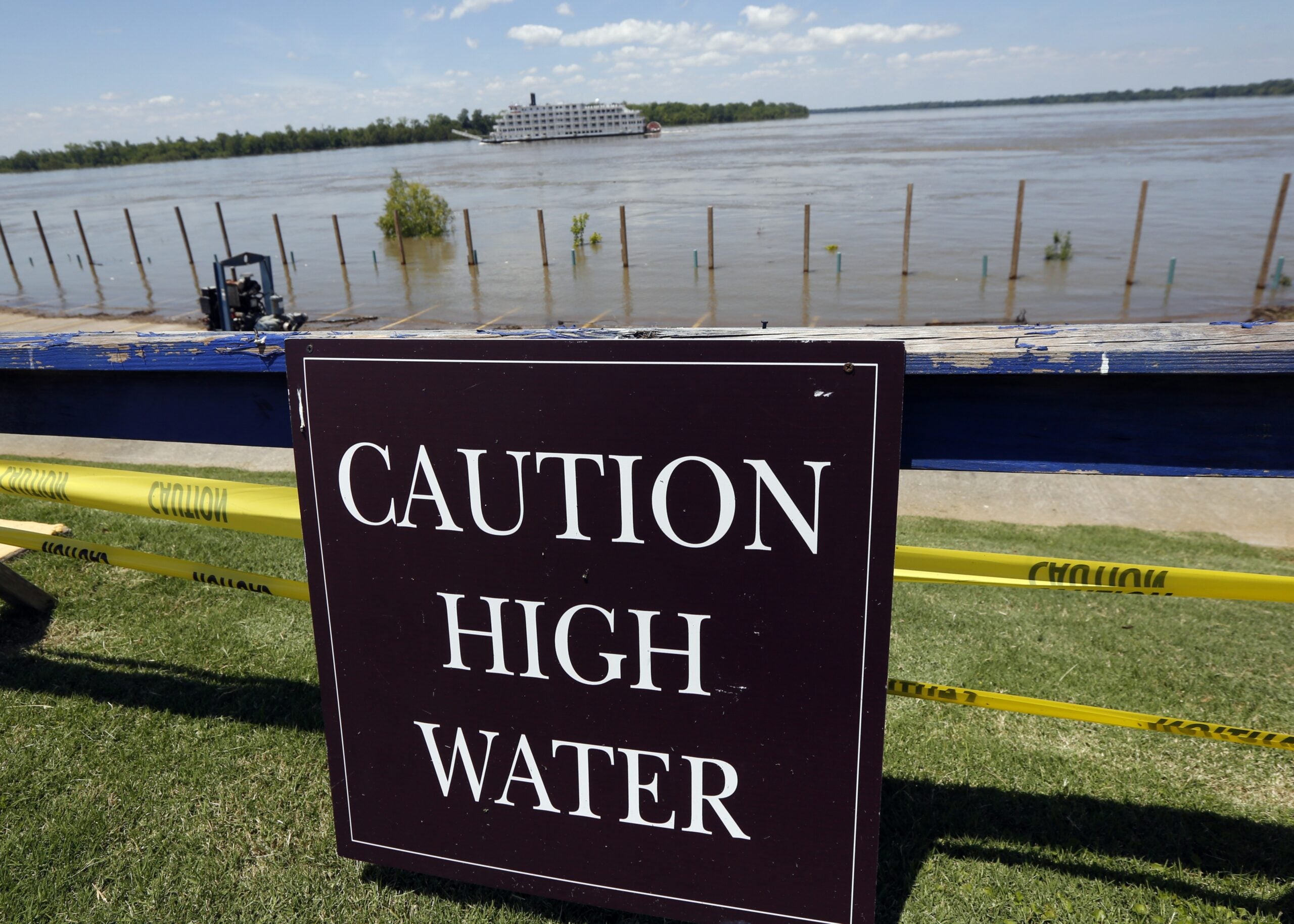
Environmental groups said a watershed study is needed soon because more intense weather is causing unusual flooding events on the river. In 2019, much of the Upper Mississippi River was above flood stage for more than 100 days. The groups also said delaying the study would hamper potential solutions to future flooding problems.
Some levies protecting Mississippi River communities south of Wisconsin failed during the prolonged flooding in 2019.
Dorothy was in downtown Davenport, Iowa when a levy gave way and caused widespread flooding.
“We’ve known for a longtime that the wetter a levy is, the less stable it is,” she said. “These flood control measures we’ve relied on in the past with these new climate change events aren’t going to be as effective.”
Decision-making power for the northern portion of the Mississippi rests in the hands of the Upper Mississippi River Basin Association (UMRBA) — an interstate organization made up of governors from Illinois, Iowa, Minnesota, Missouri and Wisconsin.
Before Congress approved the climate change study in December, UMBRA was working on its own report on the river system’s challenges. The recently released report — which does not include data on climate change — is considered a working document and is subject to change, according to UMBRA.
“Finding that common space is something we wanted to do with the report. We said, ‘Let’s bring everybody together to talk about flood, drought and sedimentation.’ That was a difficult conversation for a lot of people,” said Steve Galarneau, former president of UMBRA and the group’s Wisconsin representative.
“We can’t make a difference in the main stream of the river if we don’t get up into the watersheds,” said Galarneau, who is also the state Department of Natural Resources’ Great Waters director. “That’s where the start of the challenge is and it’s part of the solution.”
For Galarneau, commercial navigation needs to be part of any future climate change study.
The Mississippi River’s commercial navigation system, made up of a series of locks and dams, dates back to the 1930s and is used to transport hundreds of millions of dollars of goods each shipping season. It’s a major way for Upper Midwestern farmers to get grain to markets.
“(The Upper Mississippi River) is being managed as a dual-purpose system,” he said. “There’s a recognition if we’re going to have a viable shipping industry, then how do we manage that in a manner that has minimal impact on the environment, at the same time meeting the navigational challenges.”
Extreme flooding events in 2019 were also bad for shipping on the river.
And while Galarneau said he thinks UMBRA members would support doing a climate change study, he’s not sure how soon such a study will move forward.
Dorothy, of American Rivers, said environmental groups are asking governors to get involved personally and act with some urgency to get a climate change study moving.
“Every delay runs the risk of having another major flood event where we don’t have a plan in place,” Dorothy said.
She said the Congressional authority could lead to a 3-year, $3 million study that the regional states’ organization would have to provide a 25 percent match for.
UMBRA meets again at the end of May.
Wisconsin Public Radio, © Copyright 2026, Board of Regents of the University of Wisconsin System and Wisconsin Educational Communications Board.