Another series of late-summer storms was expected to pass through Wisconsin on Tuesday night and early Wednesday morning, bringing with them the threat of more flooding and possible evacuations in some areas.
The National Weather Service was investigating reports of a possible tornado that tore across central Wisconsin on Tuesday afternoon.
The weather service officials were reporting possible tornado damage in a swath across the state, extending from southern Marquette County across Green Lake County and into Fond du Lac County. The weather service will send a survey team to confirm if the damage was caused by a tornado.
News with a little more humanity
WPR’s “Wisconsin Today” newsletter keeps you connected to the state you love without feeling overwhelmed. No paywall. No agenda. No corporate filter.
A flash flood warning remains in effect until 6:45 a.m. Wednesday for Ozaukee and Washington counties.
Weather service officials said at 8:50 p.m. Tuesday that emergency management reported flash flooding across the area, with many roads closed and impassable. They said some locations that might experience flooding include West Bend, Mequon, Hartford, Brown Deer, Grafton, Cedarburg, Port Washington, Jackson, Slinger, Saukville, Bayside, Kewaskum, Thiensville, Belgium, Fredonia, Newburg, Richfield, Addison, Wayne and Nenno.
The meteorologists said a flash flood watch remains in effect overnight for Marquette, Green Lake, Fond du Lac, Sheboygan, Sauk, Columbia, Dodge, Washington, Ozaukee, Iowa, Dane, Jefferson, Waukesha, Milwaukee, Lafayette, Green, Rock, Walworth, Racine and Kenosha counties. The watch will expire at 7 a.m. Wednesday. They said some areas will still see up to 0.75 inches of additional rainfall, which could add to ongoing flooding issues.
For the full list of area road closures, visit this site.
In flood-ravaged Madison, local officials posted on the city’s flooding information website that the predicted storms moving across the state Tuesday night tracked to the north and south of the city, which meant the area received less rain than initially predicted. They said the overnight forecast has a lower risk for flash flooding in the city.
This latest round of storms come on top of the torrential rains that have fallen on parts of the state during the past week, most recently the storms that blew through western and central parts of the state late Monday night and early Tuesday morning. The heavy rains caused widespread flooding in southern Wisconsin, resulting in power outages and evacuations.
On Tuesday afternoon, Gov. Scott Walker declared a state of emergency for Fond du Lac, Juneau, La Crosse, Monroe, Vernon, and Washington counties on Tuesday evening, adding the six counties to Walker’s earlier emergency declaration for Dane County.
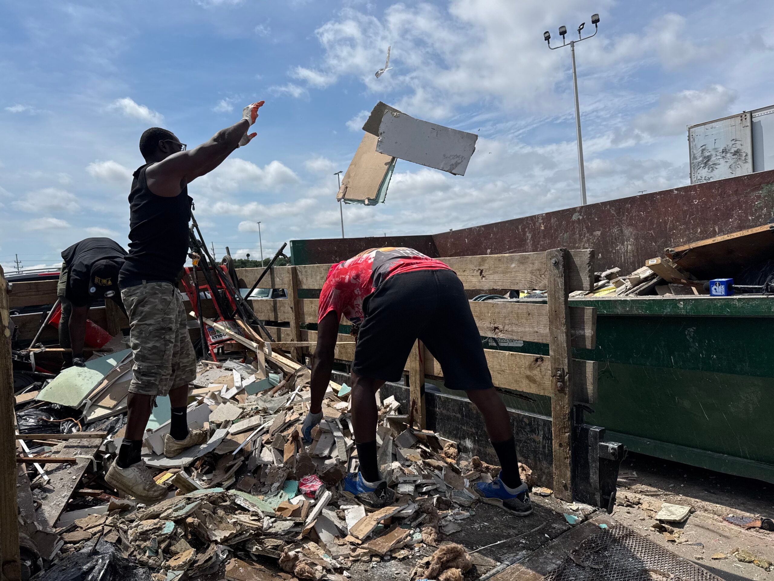
“The past 10 days have subjected our state to torrential rains and flooding, with homes and businesses damaged or destroyed,” Walker said in a press release. “I know Wisconsin will continue to effectively respond to these storms. I’m proud of our National Guardsmen, first responders, and volunteers from across the state who continue to lead the response during the cleanup and recovery.”
The governor tweeted that he planned to tour parts of western Wisconsin on Wednesday.
Wisconsin flooding shelters UPDATE: Red Cross has/will open 4 shelters for anyone in need tonight.
— Red Cross – Wisconsin (@RedCrossWIS) August 29, 2018
*Westby H.S., 206 West Ave. S. (OPEN)
*Brandon School, 200 W. Bowen St. (open ~9 p.m.)
*Reedsburg H.S., 1100 S. Albert Ave. (open ~9:30 p.m.)
*Madison West H.S., 30 Ash St. (OPEN)
Heavy Rains Fell In Parts Of State Late Monday, Early Tuesday
While forecasters said earlier in the day that as much as 5 inches of rain were possible Tuesday afternoon in already flooded areas near La Crosse reaching south to Madison, meteorologist Dan Jones said only a half an inch to an inch fell.
“We are still looking at major to near-record flooding along the Kickapoo that has not changed,” Jones said. “So, we’re just expecting the rivers to crest here over the next 24 to 36 hours along the Kickapoo River. As far as the other areas go, they’re still dealing with water over the roadways and closures.”
Anywhere from 5 to 12 inches of rain fell Monday into Tuesday across west-central and central Wisconsin, according to weather service officials. The western counties of La Crosse, Vernon and Monroe were particularly hard hit.
Residents Evacuated Tuesday In Coon Valley
By Tuesday morning, more than 100 residents were evacuated from their homes in Coon Valley where nearly a foot of rain came down, said Linda Nederlo, public information officer for Vernon County.
Lou Ann Wolff said officials came to her door at 2 a.m. to rescue her from the floodwaters.
“We didn’t get no warning until they pounded on the door to rescue us,” Wolff said. “We went out the upstairs window in a backhoe.”
Wolff said she and other residents were taken to the Village Hall, but later moved to higher ground at the Coon Valley Elementary School as water continued to rise early Tuesday morning.
Residents of the Bothne House, an assisted living facility, were evacuated Tuesday morning and taken to to Vernon Memorial Hospital and Vernon Manor, a nursing home in Viroqua, Nederlo said.
More evacuations are possible with heavy rain expected Tuesday afternoon and evening, Nederlo said.
Check out these aerial shots of Coon Valley, WI this morning.
— Bill Graul (@news8bill) August 28, 2018
Thanks to Randy Humfeld for posting these photos.#wiwx #HeavyRain #Flooding #nwsarx pic.twitter.com/Cm9P7GceuB
U.S. Highway 14 through Coon Valley remained closed to traffic Tuesday. High waters washed a large amount of debris onto a bridge over Coon Creek and washed away part of the road’s shoulder.
Water from Coon Creek reached the Coon Valley Fire Department, several blocks away.
Jeff Lenser, owner of Legacy Grill & Pub in Coon Valley, said it’s the worst flooding he’s seen in the community.
“Last time it flooded, we were just talking about, ‘Oh, it would take a lot of rain to reach us.’ And well, it happened,” Lenser said.
Lenser said he’ll have to replace everything that was in the basement, from his water heater and furnace to restaurant inventory.

Lou Ann Wolff’s garage and house on Highway 14 in Coon Valley, Wisconsin, was damaged after severe storms and flooding Monday, Aug. 27, 2018. Hope Kirwan/WPR
“There were some trees (down) and mudslides that occurred on the county roads, and I know the highway department was out in the night to clear those roadways,” Nederlo said, unsure of the progress made Tuesday morning.
Several high-water rescues happened Monday into Tuesday throughout Vernon County. According to the NWS, two people were rescued from flood water while camping near the Kickapoo River near Rockton in Vernon County. Throughout the day Tuesday, river crest predictions for the Kickapoo River fluctuated, but the weather service predicts the river to hit record highs this afternoon.
Could see some record river crests on parts of the Kickapoo River in southwest Wisconsin. Here is the hydrograph for La Farge, WI. https://t.co/ReHk1ij3qg pic.twitter.com/BWhOfUhXbn
— NWS La Crosse (@NWSLaCrosse) August 28, 2018
Several roads and bridges are closed in Monroe County because of flooded roads or damage caused by flooding, and the Monroe County Sheriff’s Office is urging people to avoid them.
On Tuesday afternoon, the Monroe County Sheriffs’ Office put out a press release saying damns near Nashville, Obel and Oakdale avenues are compromised and roads are covered with water.
The county has set up evacuation centers at the Cotter Pin in Leon, and the Barney Center and Theisen’s in Sparta. Sand bags and sand can be picked up at the animal shelter in Sparta.
The sheriff’s office is also asking private well owners who have been flooded to assume their well is contaminated, and to avoid using it until it has been tested.

The side of Highway 14 on the west side of Coon Valley, looking east into town, was washed out from flooding Monday, Aug. 27, 2018. Hope Kirwan/WPR
Parts Of State Still Recovering From Last Week’s Storms
While the overnight storms largely missed Madison, which is still recovering from last week’s storms and flooding, other areas are still reeling.
An adjustment in the Flash Flood Watch for Today/Tonight. While heavy rain threat should shift further south, it might hit similar areas from last night, in addition to far southwest Wisconsin. pic.twitter.com/FqcbGLOwwk
— NWS La Crosse (@NWSLaCrosse) August 28, 2018
The Milwaukee River near Cedarburg is primed to break crest records.
No injuries have been reported, but about 2,200 Xcel Energy customers in La Crosse lost power and the region has seen nearly 40 road closures.
The Burlington Northern Sante Fe Railroad has also reported storm-related damage to its major rail line linking Chicago, the Twin Cities and Pacific Northwest. Spokeswoman Amy McBeth said crews are assessing the situation.
“With the heavy rains that occurred we did have some areas of washouts that crews are addressing, really, south of La Crosse between Stoddard and La Crosse,” said McBeth. “So, we have had train traffic held since this morning to get those areas are addressed.”

Highway 14 on the west side of Coon Valley, looking west out of town. Parts of the highway were closed after storms flooded the town Monday, Aug. 27, 2018. Hope Kirwan/WPR

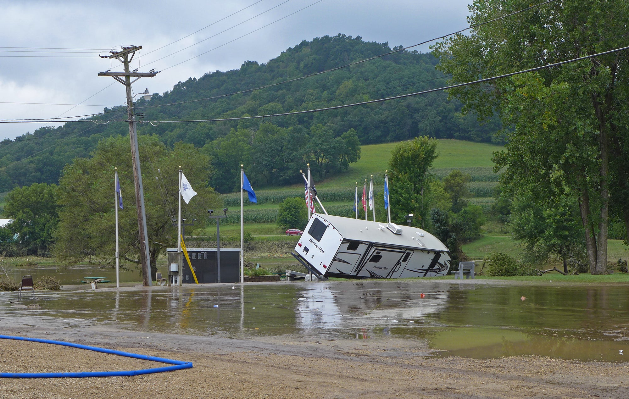
A flooded Coon Creek overflows onto Coon Valley Veterans Memorial Park after torrential storms Monday, Aug. 27, 2018. Hope Kirwan/WPR

Coon Valley Veterans Memorial Park was flooded after torrential rain caused flooding throughout the town in the southwest Wisconsin county Monday, Aug. 267, 2018. Hope Kirwan/WPR
Editor’s note: This story was last updated at 1:09 a.m. Wednesday, Aug. 29, 2018. Andrea Anderson, Bridgit Bowden, Hannah Haynes, David Hyland, Hope Kirwan, Rich Kremer, Jenny Peek and John K. Wilson contributed to this report.

Wisconsin Public Radio, © Copyright 2026, Board of Regents of the University of Wisconsin System and Wisconsin Educational Communications Board.