Federal researchers are heading up two aerial surveys of northern Wisconsin, Minnesota and Michigan to better define the geology of the upper Midwest.
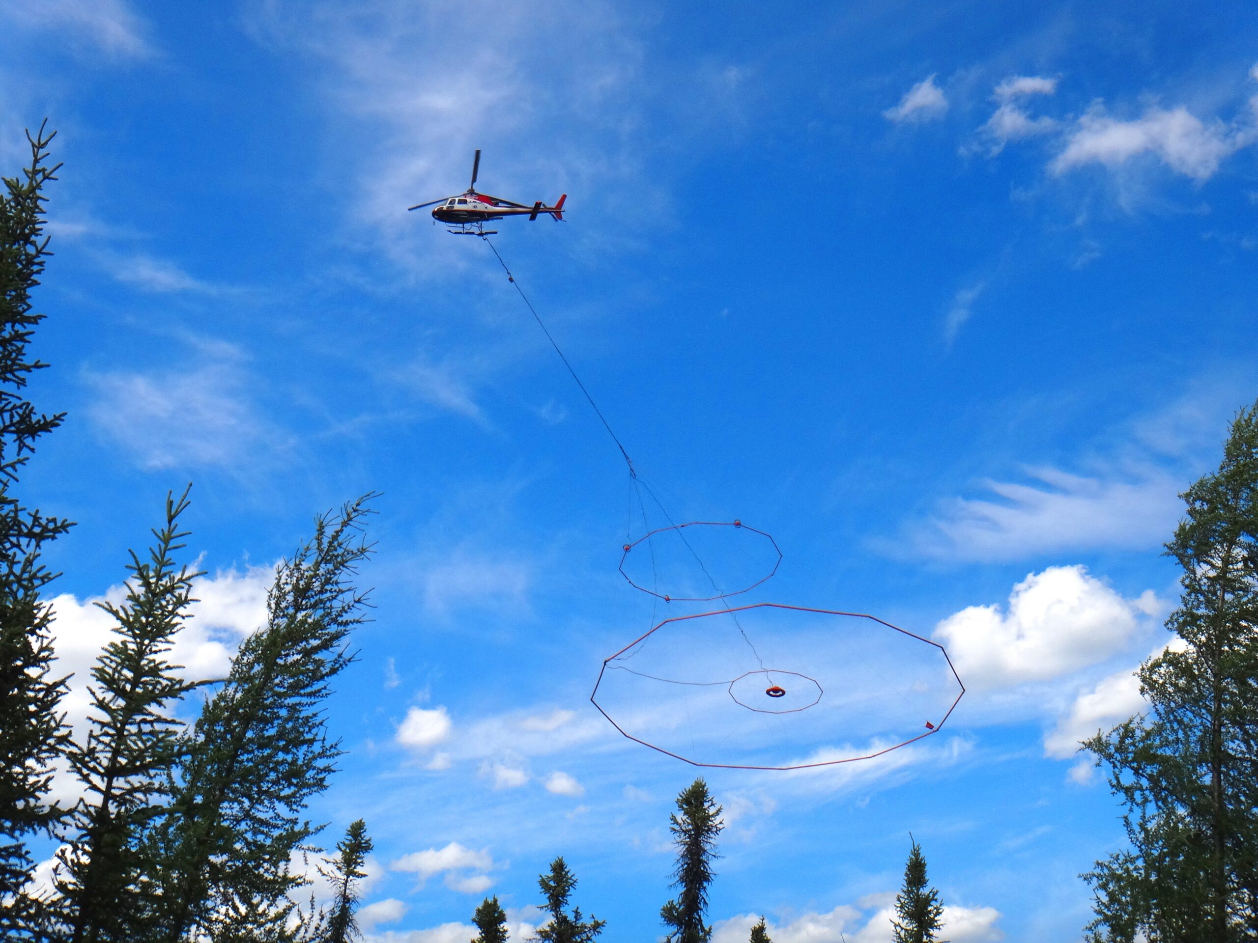
U.S. Geological Survey geophysicist Paul Bedrosian said he’s overseeing an electromagnetic survey that will be carried out by using a helicopter towing what looks like a “flying hula-hoop.” Meanwhile, fellow agency geophysicist Ben Drenth is overseeing a magnetic survey of the rocks below.
“These surveys are part of a renewed effort to use geophysics to look beneath those sediments to better understand the basic structure and geology of the region and, in turn, the implications that may have for potential mineral resources,” said Bedrosian.
Stay informed on the latest news
Sign up for WPR’s email newsletter.
Drenth said the regions they’re surveying include iron-rich areas where there’s been renewed interest in mining.
“We don’t advocate for or against mining, but we want the basic geologic information to be out there in the public domain,” he said. “A lot of that information simply doesn’t exist yet in these regions.”
Much of the information that has been collected is in the hands of private corporations that are not required to share it with the public. For the electromagnetic survey, Bedrosian said they’ll map 100-mile lines from north to south to measure the electrical conductivity of rocks. The range of the survey runs from the Twin Ports to Escanaba, Michigan. The surveys will map rocks down as far as 1,500 feet beneath the ground’s surface. The rocks they’re examining, he said, are sulfur-rich.
“They do have some relevance from a minerals industry perspective on a very largescale as to where you may have potential for additional mineral deposits,” said Bedrosian.
Drenth said local governments and decision-makers will be able to use the data to guide land use decisions.
At the same time, USGS researchers have also been studying a mineral deposit where mining company Gogebic Taconite pursued plans for an iron mine before abandoning the project last year. Drenth said they’re working with some of the same researchers, but the two projects are unrelated. Meanwhile, northern Wisconsin officials disagree on what the surveys may reveal for mining the deposit in the Penokee Range.
Kelly Klein with the Iron County Development Zone said the information could be useful as the county weighs potential for mining.
“The more scientific information you can have, the better,” Klein said. “It allows not only decision makers but the public to engage in good decisions.”
Klein said a lot of that “hard data” was missing as state and local governments evaluated GTAC’s proposal to mine. But, Ashland County Board Chair Pete Russo contends they learned enough to rule out mining in the Penokees.
“If they want to study that’s fine, but they’ve got a lot of things that are real important up there that they’re going to have to face,” said Russo. “We know what’s there already. If they survey it again, that grunerite isn’t going to go away.”
Grunerite is an amphibole mineral that contains asbestos-like fibers that have been discovered on outcroppings in the Penokees.
The electromagnetic survey began this month and will take place for the next several weeks. The magnetic survey will span the next several months. Findings will be released over the next several years.
Wisconsin Public Radio, © Copyright 2024, Board of Regents of the University of Wisconsin System and Wisconsin Educational Communications Board.