Coastal areas along Lake Superior and Lake Michigan were under a flood advisory Monday as strong winds, high lake levels and waves caused flooding along the shore. Flood advisories remain in effect along the shoreline for both lakes until 10 p.m. Monday.
Southeast winds were gusting between 35 and 45 mph along Lake Michigan with waves expected to build up to 13 feet along the lake by Monday afternoon, according to the National Weather Service.
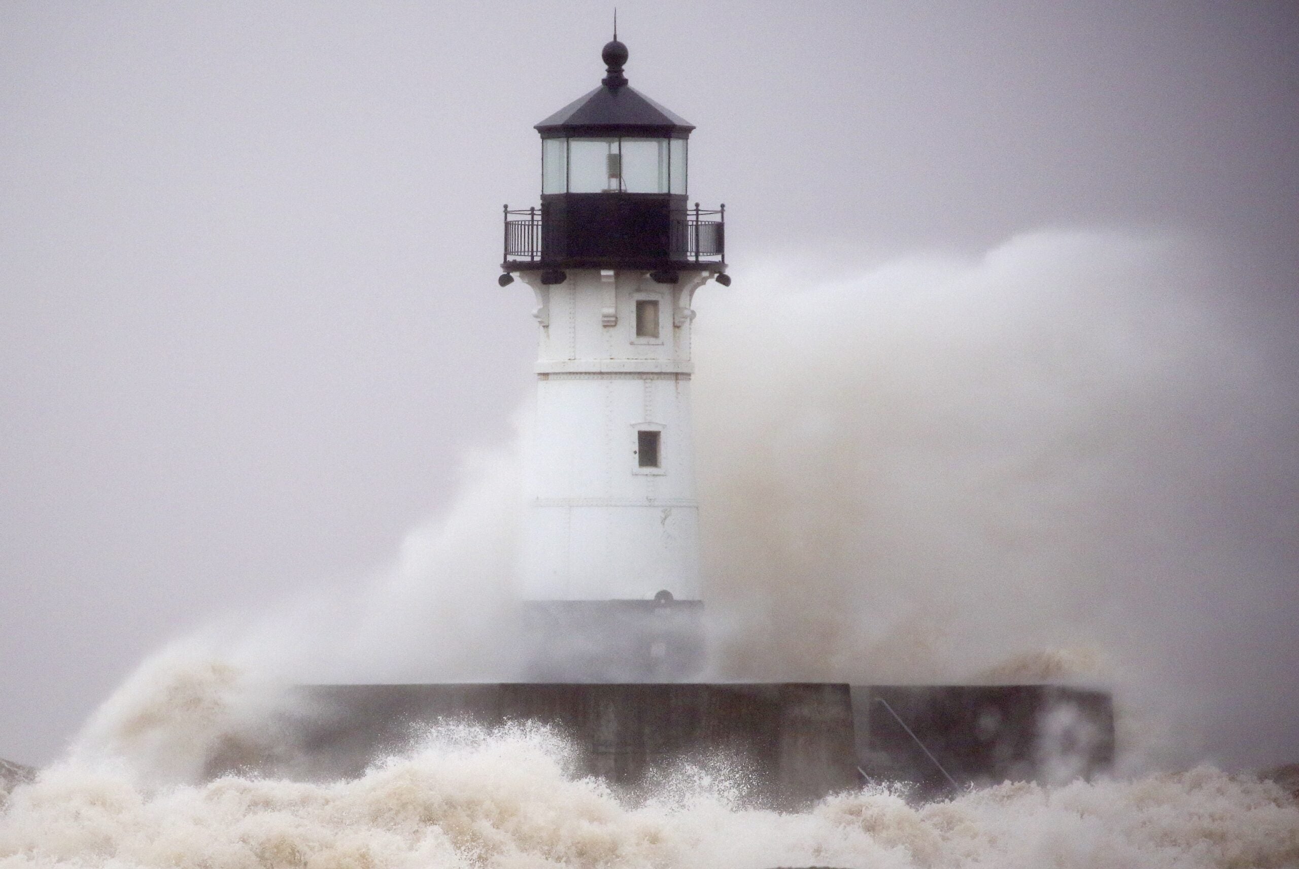
On Lake Superior, waves of up to 11 feet are expected along the south shore with higher waves possible farther out in the lake and along the north shore. Strong northeast winds are expected to exceed 50 mph at times Monday afternoon along the lake.
Stay informed on the latest news
Sign up for WPR’s email newsletter.
The National Weather Service office in Duluth had already received a report of wind gusts as high as 57 mph on the Blatnik Bridge that crosses the St. Louis River between Duluth and Superior, said meteorologist Kevin Huyck.
“Probably won’t see the kind of lakeshore erosion that we’ve seen with previous October storms,” said Huyck. “But, it will cause some flooding, especially along the Canal Park area here in Duluth and possibly over in the Barker’s Island vicinity over in Superior and possibly along Wisconsin and Minnesota Points as well.”
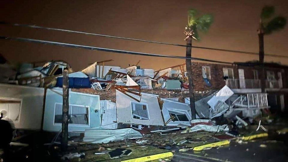
October storms along Lake Superior have caused millions of dollars in damage to Duluth’s lakefront and caused the closure of a portion of Canal Park last fall.
Huyck said he expects flooding to be shallow, but it’s possible there could be issues with water draining from the area since storm drains are at the lake level in Canal Park. The areas most impacted will span from Two Harbors to Port Wing on the Bayfield Peninsula. There were more than 8,000 people without power in the Twin Ports area around 3 p.m. Monday, according to Minnesota Power.
The City of Duluth advised people to avoid downed power lines and closed several roads and Brighton Beach due to standing water. On Monday evening, people on Park Point were also asked to shelter in place due to flooding.
Along Lake Michigan, a lakeshore flood advisory is in effect along the shore of Milwaukee, Ozaukee, Sheboygan, Door, Kewaunee, and Manitowoc counties. The areas that are expected to be most impacted are low-lying areas, roads and buildings near the lake, said Taylor Patterson, meteorologist with the National Weather Service in Sullivan.
“It’s not a good day to go out on the beach,” said Patterson.
Patterson advised people to use caution while traveling along the lakeshore Monday, which she said is expected to cause minor flooding on nearby roads and beaches.
“The higher waves will cause erosion along the Lake Michigan lakeshore as well,” she said.
Water levels on the Great Lakes are 3 to 16 inches higher than they were at the same time last year, according to the U.S. Army Corps of Engineers. Lake Michigan is nearly 3 feet above its long-term monthly average for October while Lake Superior is more than 2 feet above its monthly long-term average.
Patterson said winds are expected to shift to the southwest later Monday afternoon along Lake Michigan, causing waves to subside.
Wisconsin Public Radio, © Copyright 2024, Board of Regents of the University of Wisconsin System and Wisconsin Educational Communications Board.