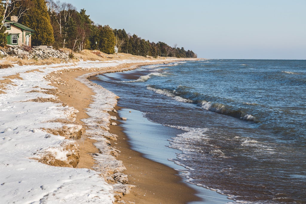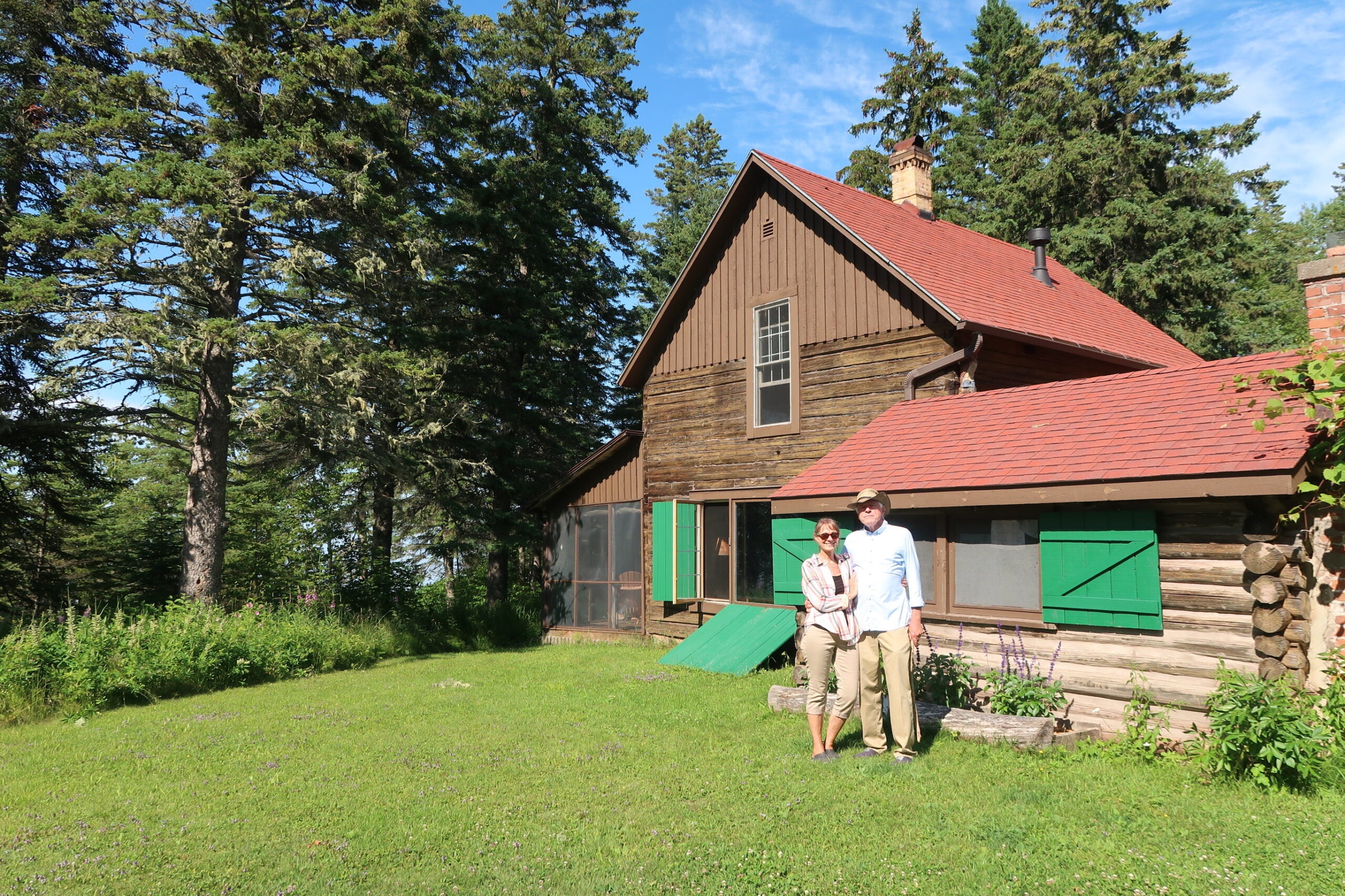
On a hot July day, Theron O’Connor gazed at the shoreline of his lakefront property — what’s left of it — just a few miles outside Cornucopia on the south shore of Lake Superior. He and his five siblings have been coming to his grandfather’s cabin here since they were kids. A Swedish immigrant named Charlie Saxine built the two-story log cabin by hand.
“It’s been in our family for about five generations,” he said.
O’Connor, who lives in Bayfield, said it’s a place they all come back to for a couple weeks a year. But the cabin just beyond the bank may not be where it is now if high lake levels and storms continue to pound the shoreline.
Stay informed on the latest news
Sign up for WPR’s email newsletter.
The Great Lakes have had a record-breaking summer so far. Lakes Erie and Ontario are seeing the highest water levels ever recorded. Lake Superior set a monthly record in June and the U.S. Army Corps of Engineers is projecting a record high for July.
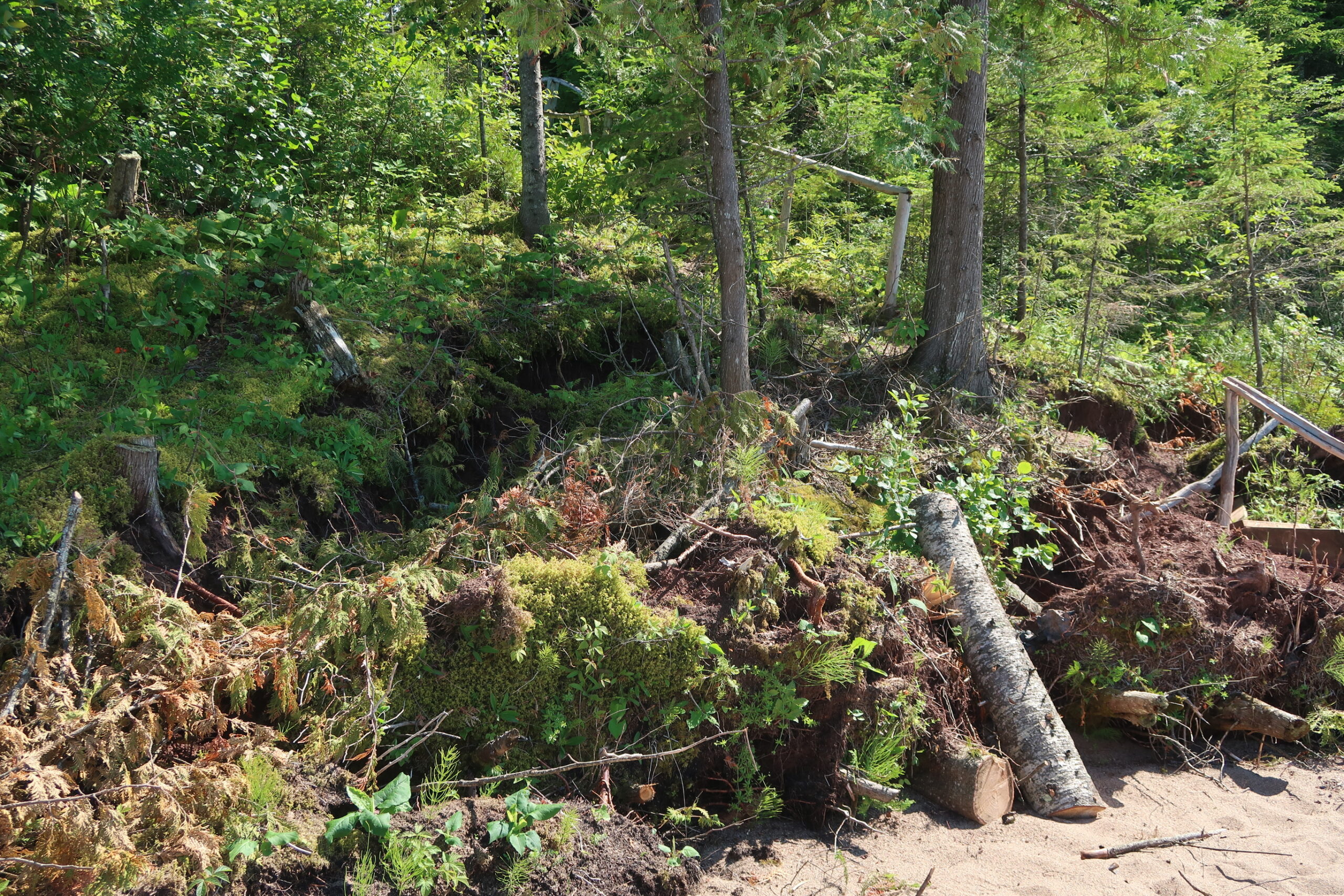
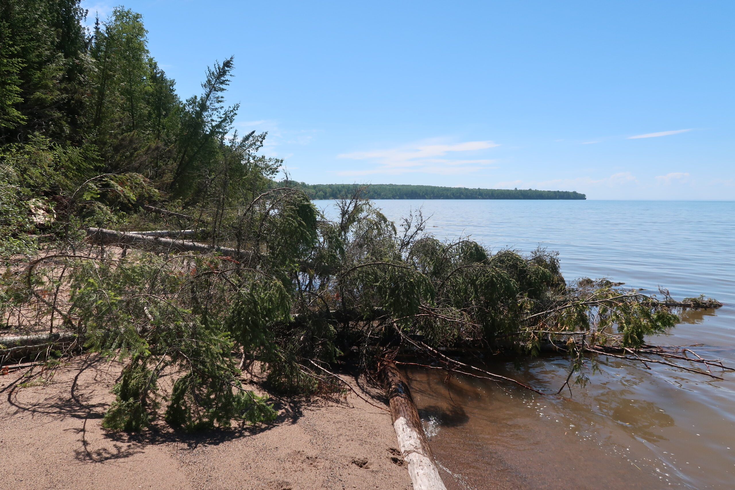
O’Connor said an October storm two years ago completely transformed the shoreline. Water washed up on the bank, undercutting it. At one time, he and his wife could walk all up and down the shore. Now, there’s little or no beach and trees angle toward the water. O’Connor said they cut some down about two months ago to keep them from tearing away the hillside.
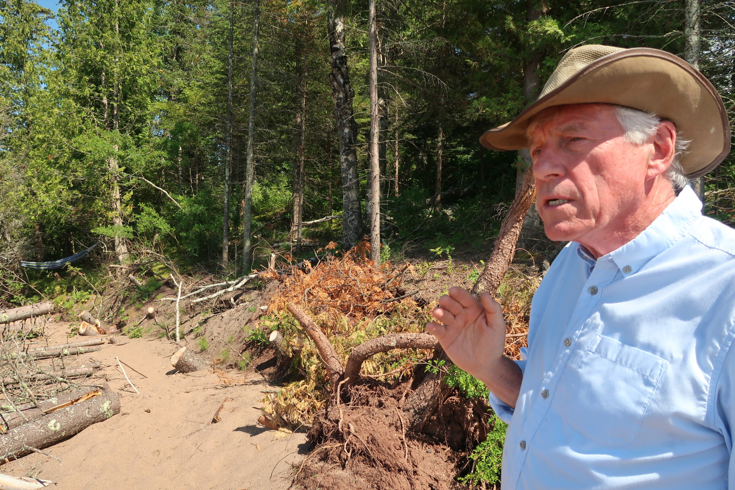
“The land is so saturated that it won’t really hold,” he said. “This is basically clay with a little bit of sandy loam on top of it, and that got absolutely saturated both from the heavy rains and snows of the last two years.”
If erosion continues to creep closer, O’Connor said they may have to move his grandfather’s cabin back several hundred feet from the shore. There’s not much else he can do. He’s considered spending tens of thousands of dollars on rip rap to reinforce the shoreline.
“But, people have done that here and the lake has taken it away as quickly as they’ve put it in,” he said.
Even if lake levels go down, his wife Demaris Brinton said that won’t stop the rain from weakening the hillside.
“That water comes down like somebody has turned over Lake Superior on top of us,” she said. “It’s a remarkable amount of water coming down at once.”
In recent years, the region has been no stranger to severe storms that have brought 100-year rainfalls (those expected to have a 1 percent chance of occurring within any given year.) In June 2018, the northern Wisconsin town of Drummond saw rains over a three-day period that have a chance of occurring once in a millenium. In the last seven years, northern Wisconsin has dealt with millions of dollars of damage from three floods that resulted in federal disaster declarations.
Meteorological data from NOAA’s Atlas 14 show the chance the area could see such 100-year storms over a 24-hour period has increased by more than a third, said Matt Hudson, associate director of the Mary Griggs Burke Center for Freshwater Innovation at Northland College in Ashland.
“It’s likely that that estimate should be even higher now that we’ve been having these recent events occurring,” said Hudson. “There definitely seems to be something happening specifically in this region. I don’t think we’ve officially nailed what the meteorological or climate-related reason is for it.”
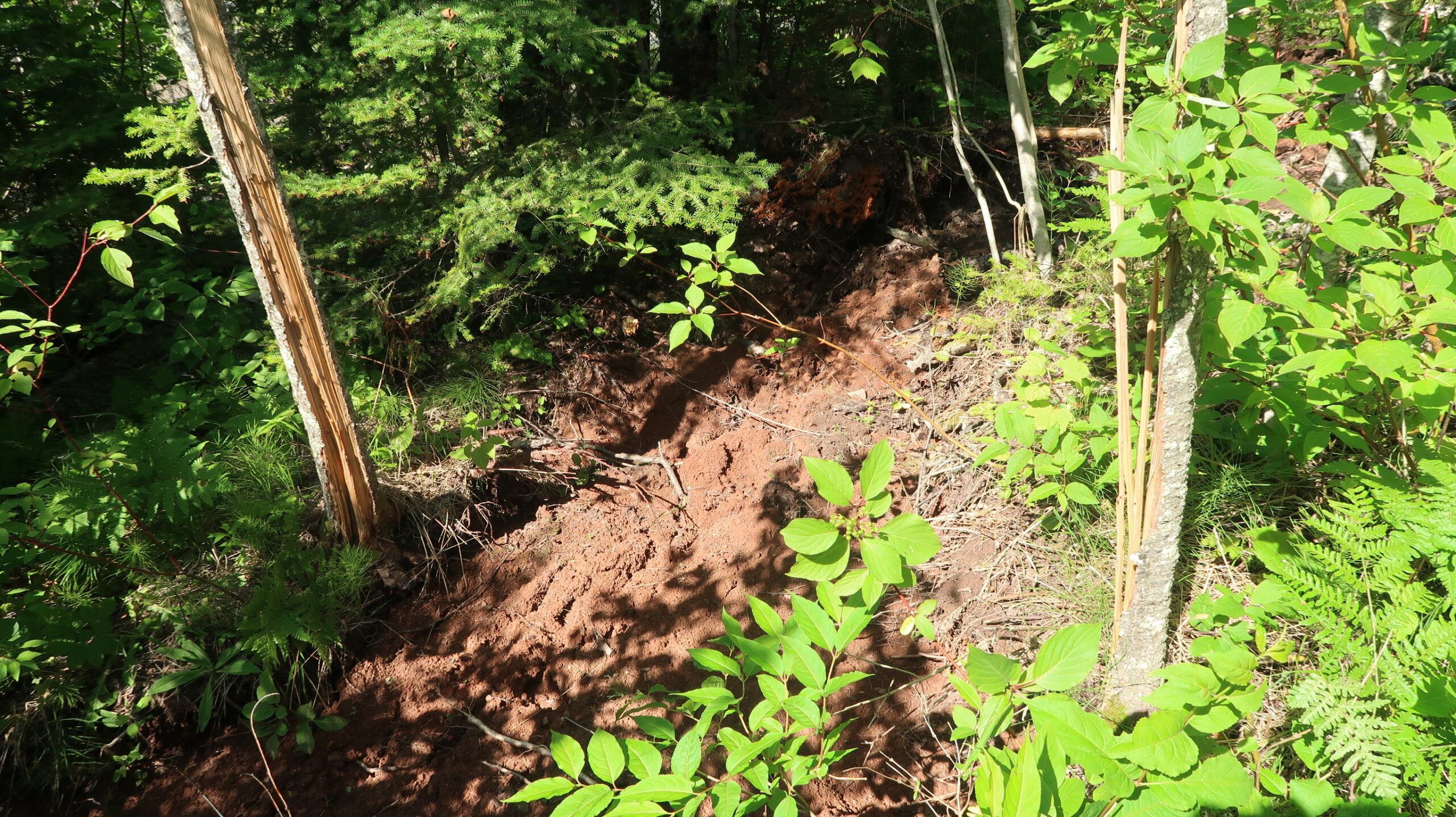
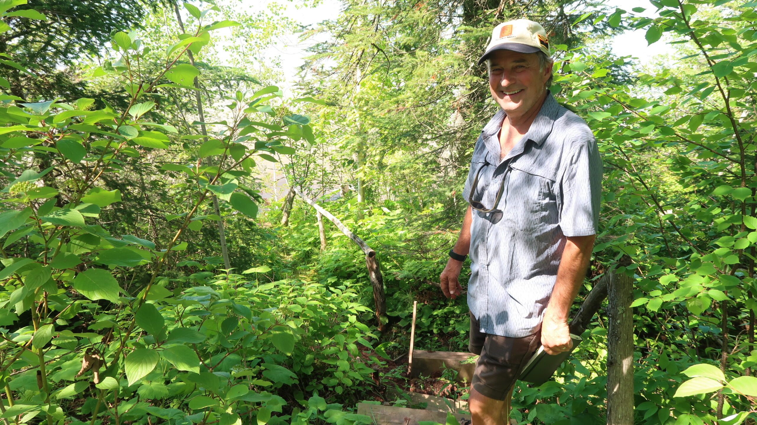
Just a short trek through the woods to the west from O’Connor’s and Brinton’s cabin, Ken Pray and his family own the home nextdoor. Pray, who’s now retired and lives in Cincinnati, walked along a trail near large rifts in the soil where the hillside is slumping downward. He pointed to a tree where a hammock had once been tied. Now, it stands in two pieces several feet apart — the trunk split down the middle from erosion.

The beach in front of Ken Pray’s home is clearly visible prior to erosion from high water levels and storms a couple years ago. Photo courtesy of Ken Pray

Ken Pray’s home can be seen in the background as water levels over the last few years have encroached on the shoreline. Photo courtesy of Ken Pray
Pray thinks the erosion would be much worse if not for all the trees lining the hillside.
“I think typically a lot of people would say, ‘I want a nice view of that point so let’s get those trees out of there,’” said Pray. “That’s, then, where you get in trouble because it’s only the roots. That’s all you got.”
Bayfield County Planning and Zoning Director Rob Schierman said maintaining vegetation along lake bluffs and directing runoff away from the banks helps keep soil in place. He said proper land management has been a constant battle with lakefront property owners.
“If you’re going to be cutting down all the vegetation so you can see the lake like you’re looking at a picture, you can expect to have problems with erosion,” he said. “And, your structure might not last as long as you want.”
Schierman said several cabins or homes are moved back from shoreline in Bayfield County each year. High water levels and storms have only made the problem worse, resulting in millions of dollars in damage across the Great Lakes.
Some lakefront communities are blaming the International Joint Commission, which oversees water flows. But, Keith Kompoltowicz, chief of watershed hydrology with the U.S. Army Corps of Engineers, said the ability to control outflows doesn’t mean you can control lake levels.
“It’s a matter of scale, to be quite honest,” he said. “Lake Superior is extremely large and the variability in the rainfall, runoff and evaporation that falls on Lake Superior is much greater than the ability to increase or decrease outflow.”
The International Lake Superior Board of Control said in a July 3 release that the International Joint Commission has allowed higher outflows from Lake Superior into the St. Marys River than those that were set in its 2012 plan. However, Kompoltowicz said outflows are being increased to make up for lower flows earlier this year due to maintenance on hydropower plants along the river.
Record high levels on the Great Lakes come on the heels of record low water levels, said Drew Gronewold, associate professor with the University of Michigan School for Environment and Sustainability. Gronewold said university researchers are now exploring whether changes in the lakes are normal or the result of climate change.
[[{“fid”:”461746″,”view_mode”:”full_width”,”fields”:{“alt”:”Great Lakes from space”,”title”:”Great Lakes from space”,”class”:”media-element file-full-width”,”data-delta”:”7″,”format”:”full_width”,”alignment”:””,”field_image_caption[und][0][value]”:”%3Cp%3E%3Cem%3E%3Ca%20href%3D%22https%3A%2F%2Fwww.flickr.com%2Fphotos%2Fgsfc%2F4968915002%2Fin%2Fphotolist-8z5Zjj-aEW9VQ-mw8S3M-abfev7-bm6piy-pPNjM1-avwoD5-eLy5rj-eUFD67-k2pyD7-fMQTv4-nMecA2-dv67bB-dBKvNV-qJRA92-rkyfNw-j1MuP3-j67R98-kYwXMt-dfRRoo-iemebw-a2JErh-kWfKv7-doAVUj-6NMCgt-hH8j8m-bFky2c-aqTYcf-axPWSY-azi1jJ-iSBd3V-doCuYW-aqBX2t-aqTYbm-bqxyZs-fGucYM-iKxDce-fFas5M-ntPL6U-faKQfb-pMFDJE-rpfBqW-79HNH8-79HPpc-9RCPPP-dzERHs-ksWe3b-aJBXXP-9ioQTi-79MKTW%22%3ENASA%20Goddard%20Space%20Flight%20Center%3C%2Fa%3E%26nbsp%3B%3Cspan%3E(%3Cspan%20property%3D%22identifier%22%3ECC%20BY%3C%2Fspan%3E)%3C%2Fspan%3E%3C%2Fem%3E%3C%2Fp%3E%0A”,”field_image_caption[und][0][format]”:”filtered_html”,”field_file_image_alt_text[und][0][value]”:”Great Lakes from space”,”field_file_image_title_text[und][0][value]”:”Great Lakes from space”},”type”:”media”,”field_deltas”:{“7”:{“alt”:”Great Lakes from space”,”title”:”Great Lakes from space”,”class”:”media-element file-full-width”,”data-delta”:”7″,”format”:”full_width”,”alignment”:””,”field_image_caption[und][0][value]”:”%3Cp%3E%3Cem%3E%3Ca%20href%3D%22https%3A%2F%2Fwww.flickr.com%2Fphotos%2Fgsfc%2F4968915002%2Fin%2Fphotolist-8z5Zjj-aEW9VQ-mw8S3M-abfev7-bm6piy-pPNjM1-avwoD5-eLy5rj-eUFD67-k2pyD7-fMQTv4-nMecA2-dv67bB-dBKvNV-qJRA92-rkyfNw-j1MuP3-j67R98-kYwXMt-dfRRoo-iemebw-a2JErh-kWfKv7-doAVUj-6NMCgt-hH8j8m-bFky2c-aqTYcf-axPWSY-azi1jJ-iSBd3V-doCuYW-aqBX2t-aqTYbm-bqxyZs-fGucYM-iKxDce-fFas5M-ntPL6U-faKQfb-pMFDJE-rpfBqW-79HNH8-79HPpc-9RCPPP-dzERHs-ksWe3b-aJBXXP-9ioQTi-79MKTW%22%3ENASA%20Goddard%20Space%20Flight%20Center%3C%2Fa%3E%26nbsp%3B%3Cspan%3E(%3Cspan%20property%3D%22identifier%22%3ECC%20BY%3C%2Fspan%3E)%3C%2Fspan%3E%3C%2Fem%3E%3C%2Fp%3E%0A”,”field_image_caption[und][0][format]”:”filtered_html”,”field_file_image_alt_text[und][0][value]”:”Great Lakes from space”,”field_file_image_title_text[und][0][value]”:”Great Lakes from space”}},”link_text”:false,”attributes”:{“alt”:”Great Lakes from space”,”title”:”Great Lakes from space”,”class”:”media-element file-full-width”,”data-delta”:”7″}}]]
He said evaporation and high lake temperatures contributed to a period of below-average and record-low levels particularly for Lakes Michigan, Huron and Superior from 1998 to 2013.
“Then, this arctic polar vortex deformation in 2014, we claim, had an unusually significant impact because of that evaporation regime,” said Gronewold. “In other words, lake temperatures were high. Evaporation was high. This big blast of cold arctic air comes into the region, freezes the lakes, makes them very cold, and during that transition we go from a period of near-record lows and below-average lows to a period of persistent highs and one of the most rapid increases in water levels in Great Lakes history.”
Gronewold said they’re focusing on whether factors like increased evaporation and lake temperatures along with increased precipitation have prompted profound changes to the lakes that would not have occurred if not for climate change.
“So, what we’re trying to understand better is to what extent is this amplification of those two extremes leading to swings in water levels from one extreme to the other,” he said.
It’s hard to predict what lake levels will look like over the long-term, Gronewold said, but history has shown they’re likely to go up and down. Lakefront property owners like O’Connor hope they fall sooner rather than later to avoid further shoreline erosion.
“It could be that this will kind of heal up again and go back and be stable to rain again,” O’Connor said. “We’ll see.”
Until then, he said they’re pulling together engineering and construction details in case they have to move his grandfather’s cabin back from the shoreline.
Wisconsin Public Radio, © Copyright 2024, Board of Regents of the University of Wisconsin System and Wisconsin Educational Communications Board.